MyTopo
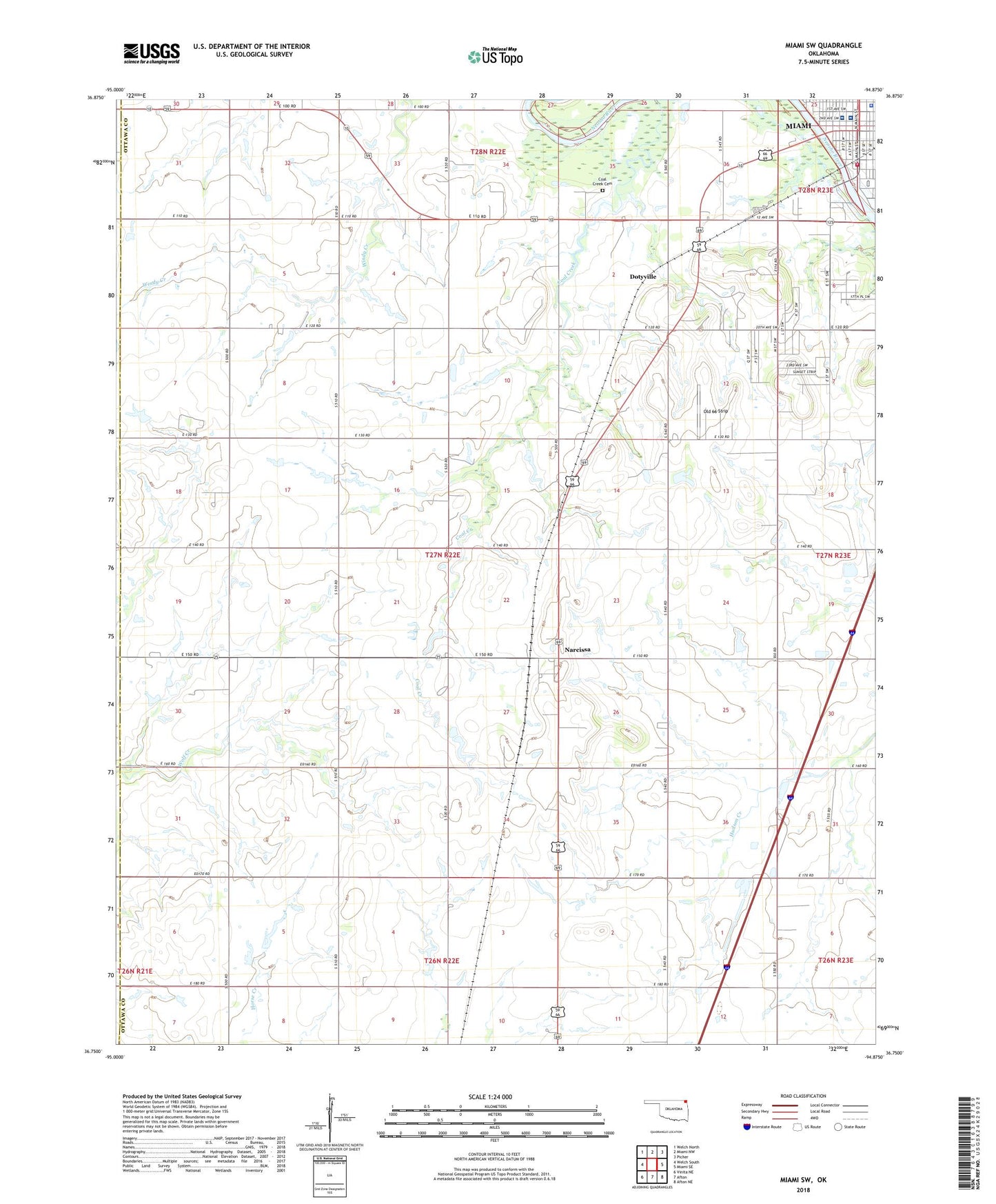
Miami SW Oklahoma US Topo Map
Couldn't load pickup availability
2022 topographic map quadrangle Miami SW in the state of Oklahoma. Scale: 1:24000. Based on the newly updated USGS 7.5' US Topo map series, this map is in the following counties: Ottawa, Craig. The map contains contour data, water features, and other items you are used to seeing on USGS maps, but also has updated roads and other features. This is the next generation of topographic maps. Printed on high-quality waterproof paper with UV fade-resistant inks.
Quads adjacent to this one:
West: Welch South
Northwest: Welch North
North: Miami NW
Northeast: Picher
East: Miami SE
Southeast: Afton NE
South: Afton
Southwest: Vinita NE
This map covers the same area as the classic USGS quad with code o36094g8.
Contains the following named places: Central Christian Church, Coal Creek Cemetery, Dotyville, Dotyville Census Designated Place, Integris Miami Hospital, Liberty Baptist Church, Lincoln School, Lone Star Church, Miami, Miami Division, Miami Fire Department South Station, Ministerial Alliance Church, Mound Valley Church, Mound Valley School, Narcissa, Narcissa Census Designated Place, Old 66 Strip, Ottawa County Jail, Ottawa County Sheriff's Office, Ottawa Non-Community, Presbyterian Church, Sacred Heart School, Township of Narcissa, Willow Crest Hospital