MyTopo
Welch South Oklahoma US Topo Map
Couldn't load pickup availability
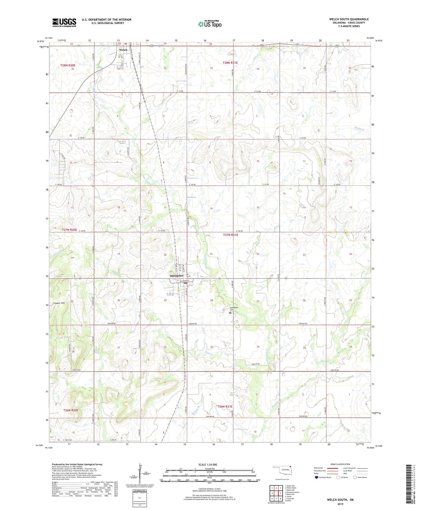
2019 topographic map quadrangle Welch South in the state of Oklahoma. Scale: 1:24000. Based on the newly updated USGS 7.5' US Topo map series, this map is in the following counties: Craig. The map contains contour data, water features, and other items you are used to seeing on USGS maps, but also has updated roads and other features. This is the next generation of topographic maps. Printed on high-quality waterproof paper with UV fade-resistant inks.
Quads adjacent to this one:
West: Pyramid Corners
Northwest: Welch NW
North: Welch North
Northeast: Miami NW
East: Miami SW
Southeast: Afton
South: Vinita NE
Southwest: Vinita
Contains the following named places: Beachner Grain Elevator Number 18, Bluejacket, Bluejacket Cemetery, Bluejacket Elementary School, Bluejacket High School, Bluejacket Middle / High School, Bluejacket Post Office, Bluejacket Volunteer Fire Department, Crow Creek, Methodist Church, Timber Hill, Town of Bluejacket, Town of Welch, Township 4, Welch, Welch Elementary, Welch Elementary School, Welch Middle and High School, Welch Post Office, Wolf Creek, ZIP Code: 74333