MyTopo
Afton Oklahoma US Topo Map
Couldn't load pickup availability
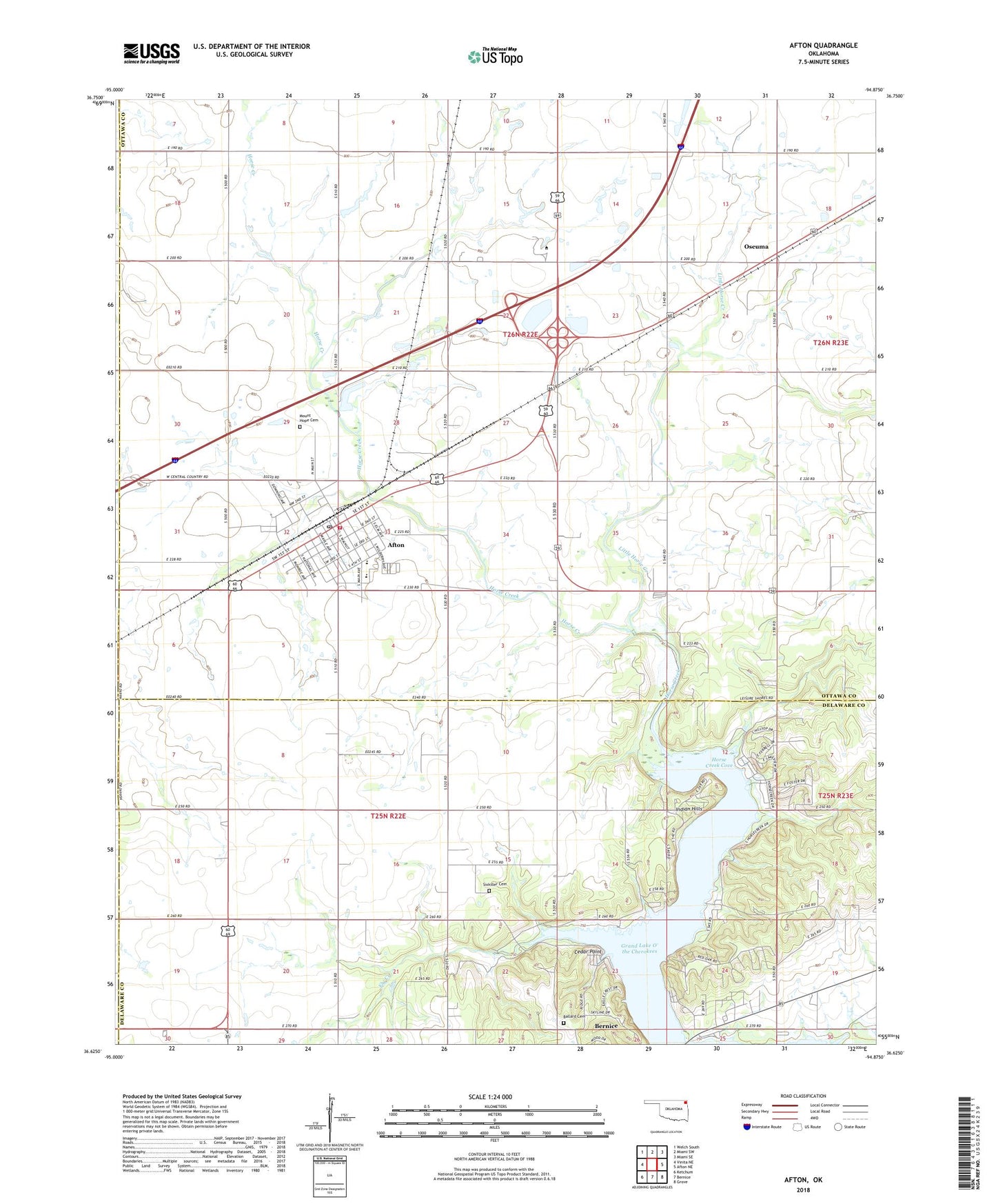
2022 topographic map quadrangle Afton in the state of Oklahoma. Scale: 1:24000. Based on the newly updated USGS 7.5' US Topo map series, this map is in the following counties: Ottawa, Delaware, Craig. The map contains contour data, water features, and other items you are used to seeing on USGS maps, but also has updated roads and other features. This is the next generation of topographic maps. Printed on high-quality waterproof paper with UV fade-resistant inks.
Quads adjacent to this one:
West: Vinita NE
Northwest: Welch South
North: Miami SW
Northeast: Miami SE
East: Afton NE
Southeast: Grove
South: Bernice
Southwest: Ketchum
This map covers the same area as the classic USGS quad with code o36094f8.
Contains the following named places: Afton, Afton Fire Department, Afton High School, Afton Middle School, Afton Post Office, Ballard Cemetery, Baptist First Church, Beachner Grain Elevator Number 2, Bernice State Park, Cedar Point, Fly Creek, Horse Creek, Horse Creek Cove, Indian Hills, Integrity Emergency Medical Services of Oklahoma, Little Horse Creek, Mount Hope Cemetery, Northeast Technology Center - Afton, Oseuma, Sixkiller Cemetery, Town of Afton, Township of Afton, Trinity Southern Baptist Church, ZIP Code: 74331