MyTopo
Vinita NE Oklahoma US Topo Map
Couldn't load pickup availability
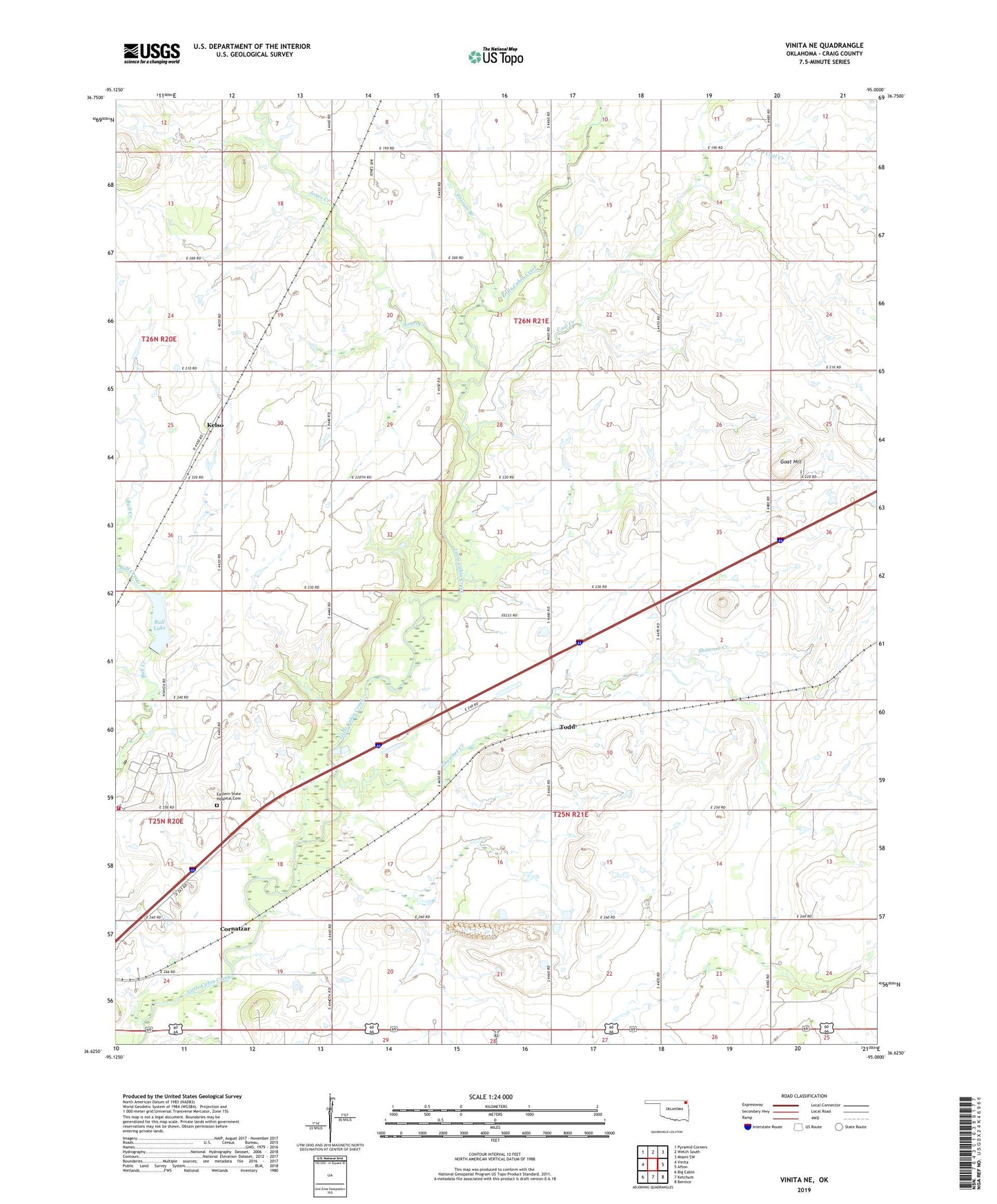
2022 topographic map quadrangle Vinita NE in the state of Oklahoma. Scale: 1:24000. Based on the newly updated USGS 7.5' US Topo map series, this map is in the following counties: Craig. The map contains contour data, water features, and other items you are used to seeing on USGS maps, but also has updated roads and other features. This is the next generation of topographic maps. Printed on high-quality waterproof paper with UV fade-resistant inks.
Quads adjacent to this one:
West: Vinita
Northwest: Pyramid Corners
North: Welch South
Northeast: Miami SW
East: Afton
Southeast: Bernice
South: Ketchum
Southwest: Big Cabin
This map covers the same area as the classic USGS quad with code o36095f1.
Contains the following named places: Bull Lake, Carter Church, Coal Creek, Cornatzar, Craig Heliport, Eastern Oklahoma Hospital Dam, Eastern Oklahoma State Hospital Cemetery, Goat Hill, Jones Creek, Kelso, Oklahoma Forensic Center, Possum Branch, Shawnee Creek, Todd, Township 7, Township 9, Vinita East Division