MyTopo
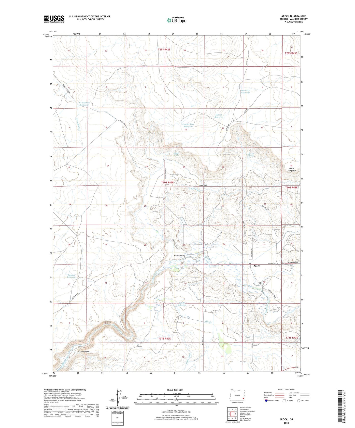
Arock Oregon US Topo Map
Couldn't load pickup availability
2024 topographic map quadrangle Arock in the state of Oregon. Scale: 1:24000. Based on the newly updated USGS 7.5' US Topo map series, this map is in the following counties: Malheur. The map contains contour data, water features, and other items you are used to seeing on USGS maps, but also has updated roads and other features. This is the next generation of topographic maps. Printed on high-quality waterproof paper with UV fade-resistant inks.
Quads adjacent to this one:
West: Owyhee Butte
Northwest: Lambert Rocks
North: Bogus Bench
Northeast: Jordan Craters South
East: Threemile Hill
Southeast: Dry Creek Rim
South: Scott Reservoir
Southwest: Rome
This map covers the same area as the classic USGS quad with code o42117h5.
Contains the following named places: Arock, Arock Cemetery, Arock Post Office, Boney Canyon, Dog Lake Reservoir, Dry Creek, Eiguren Ranch, Elwood Ranch, Fretwell Ranch, Grafton Ranch, Grahams Hill, Greene Ranch, Hidden Valley, John Lequerica Ranch, Jones School, Juniper Spring, Juniper Tree Reservoir, Larrusea Ranch, Loren Miller Ranch, Lynde Reservoir, Merrill Springs, Merrill Springs Rim, No Catchum Reservoir, North Side Canal, Owyhee Butte Well, Pascual Reservoir, Sheep Ranch, Stitzel Ranch, Uriquiaga Ranch