MyTopo
Bingham Springs Oregon US Topo Map
Couldn't load pickup availability
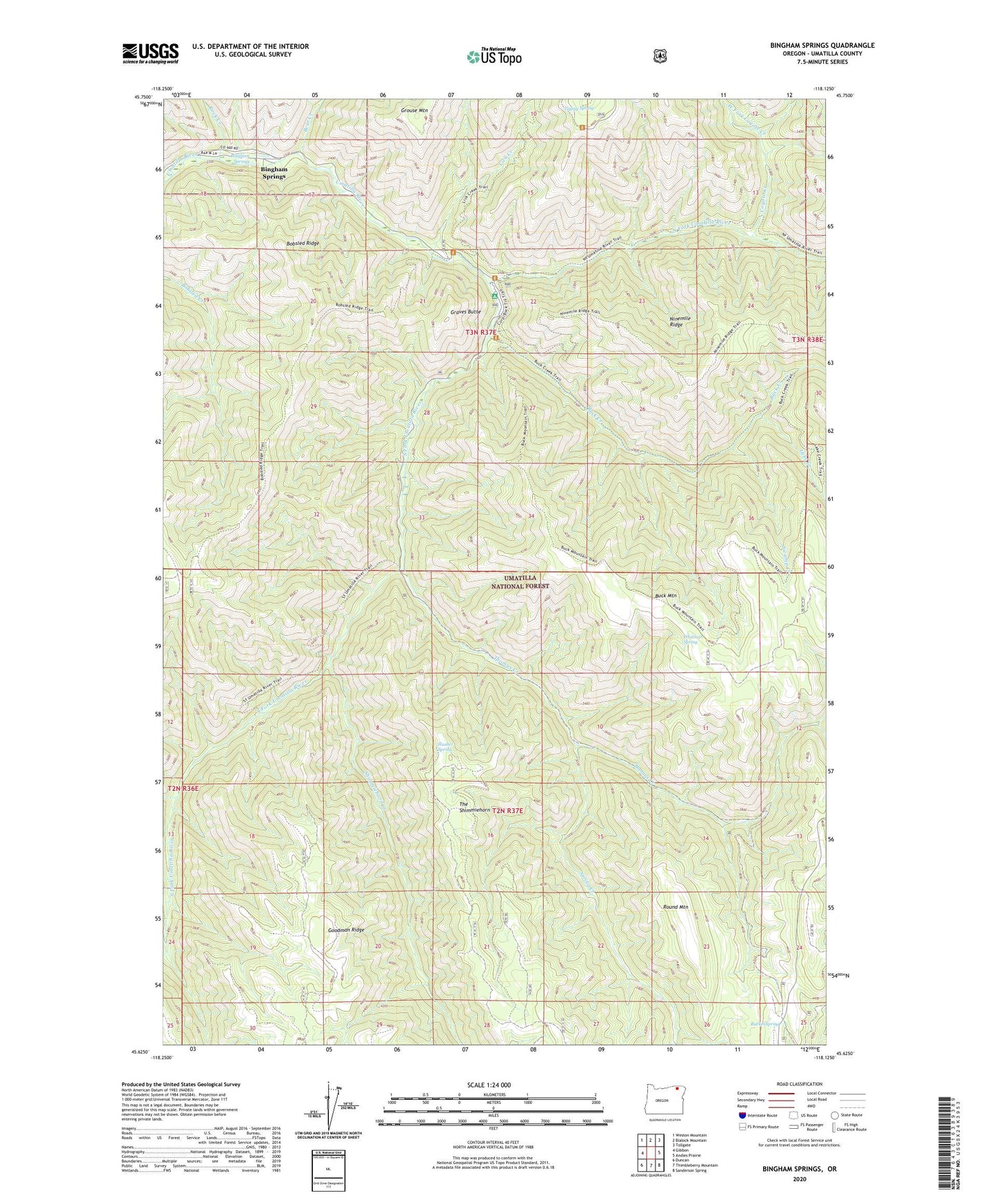
2020 topographic map quadrangle Bingham Springs in the state of Oregon. Scale: 1:24000. Based on the newly updated USGS 7.5' US Topo map series, this map is in the following counties: Umatilla. The map contains contour data, water features, and other items you are used to seeing on USGS maps, but also has updated roads and other features. This is the next generation of topographic maps. Printed on high-quality waterproof paper with UV fade-resistant inks.
Quads adjacent to this one:
West: Gibbon
Northwest: Weston Mountain
North: Blalock Mountain
Northeast: Tollgate
East: Andies Prairie
Southeast: Sanderson Spring
South: Thimbleberry Mountain
Southwest: Duncan
Contains the following named places: Bar M Ranch, Bear Creek, Bingham Springs, Bobsled Trail, Buck Creek, Buck Creek Group Camp, Buck Mountain, Corporation Guard Station, Coyote Creek, East Fork Coyote Creek, Elk Campground, Graves Butte, Grouse Mountain, Lake Creek, Lick Creek, Lick Creek Trail, North Fork Umatilla River, North Fork Umatilla Wilderness, Purdy Post Office, Rock Creek, Round Mountain, Ruckel Junction, Ruckel Ridge, Ruckel Spring, Shimmiehorn Creek, Slusher Spring, South Fork Campground, South Fork Umatilla River, Spring Creek, Swamp Creek, Thomas Creek, Umatilla Forks Recreation Site, West Fork Coyote Creek, Whitman Spring, Zigzag Spring