MyTopo
Weston Mountain Oregon US Topo Map
Couldn't load pickup availability
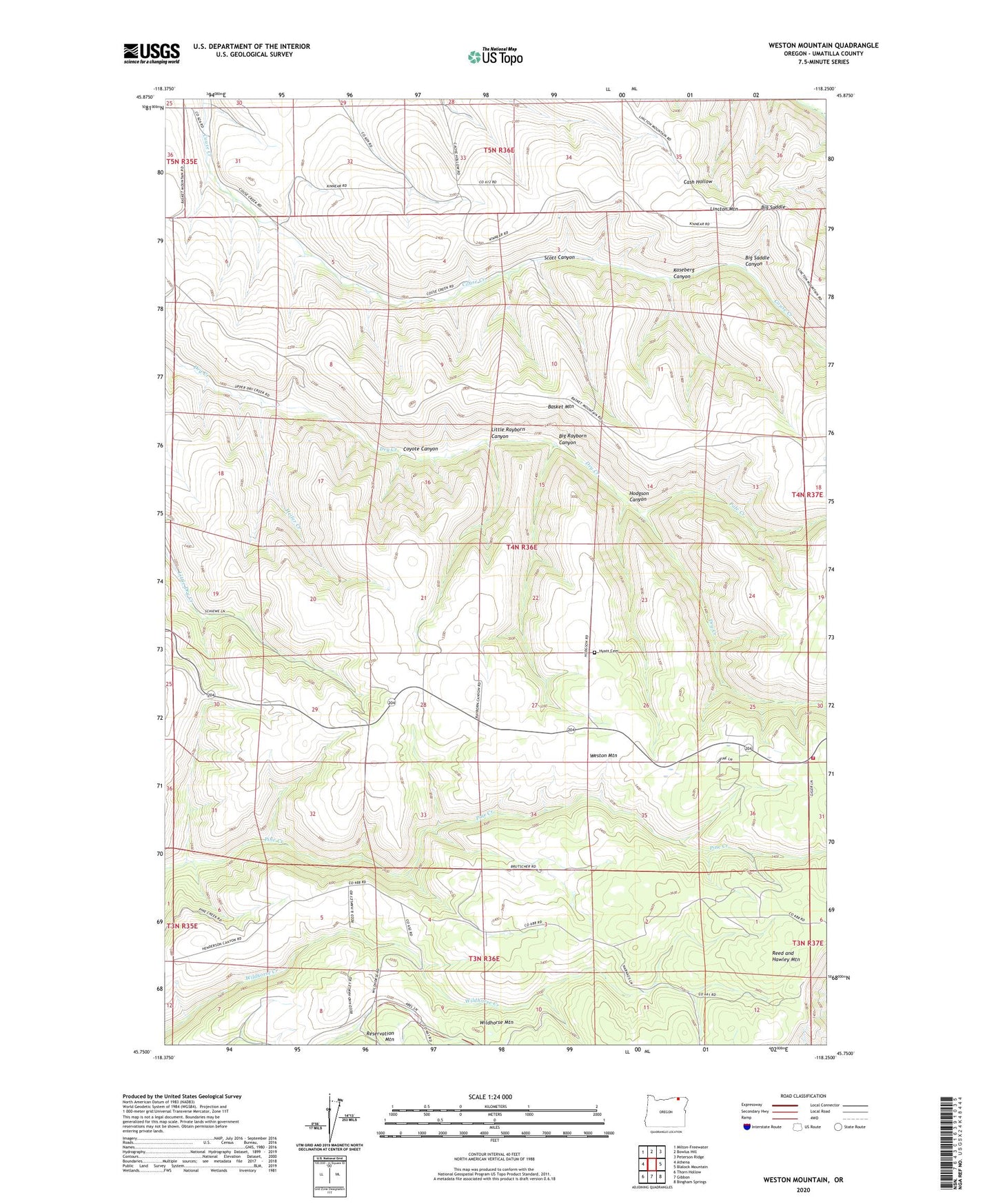
2023 topographic map quadrangle Weston Mountain in the state of Oregon. Scale: 1:24000. Based on the newly updated USGS 7.5' US Topo map series, this map is in the following counties: Umatilla. The map contains contour data, water features, and other items you are used to seeing on USGS maps, but also has updated roads and other features. This is the next generation of topographic maps. Printed on high-quality waterproof paper with UV fade-resistant inks.
Quads adjacent to this one:
West: Athena
Northwest: Milton-Freewater
North: Bowlus Hill
Northeast: Peterson Ridge
East: Blalock Mountain
Southeast: Bingham Springs
South: Gibbon
Southwest: Thorn Hollow
This map covers the same area as the classic USGS quad with code o45118g3.
Contains the following named places: Big Rayborn Canyon, Big Saddle, Big Saddle Canyon, Briggson Post Office, Coyote Canyon, East Umatilla County Rural Fire Protection District Station 3, Heifer Creek, Hodgson Canyon, Hyatt Cemetery, Kaseberg Canyon, Little Rayborn Canyon, Pole Creek, Scott Canyon, Tamarack Post Office, Weston Division, Wildhorse Mountain, ZIP Code: 97886