MyTopo
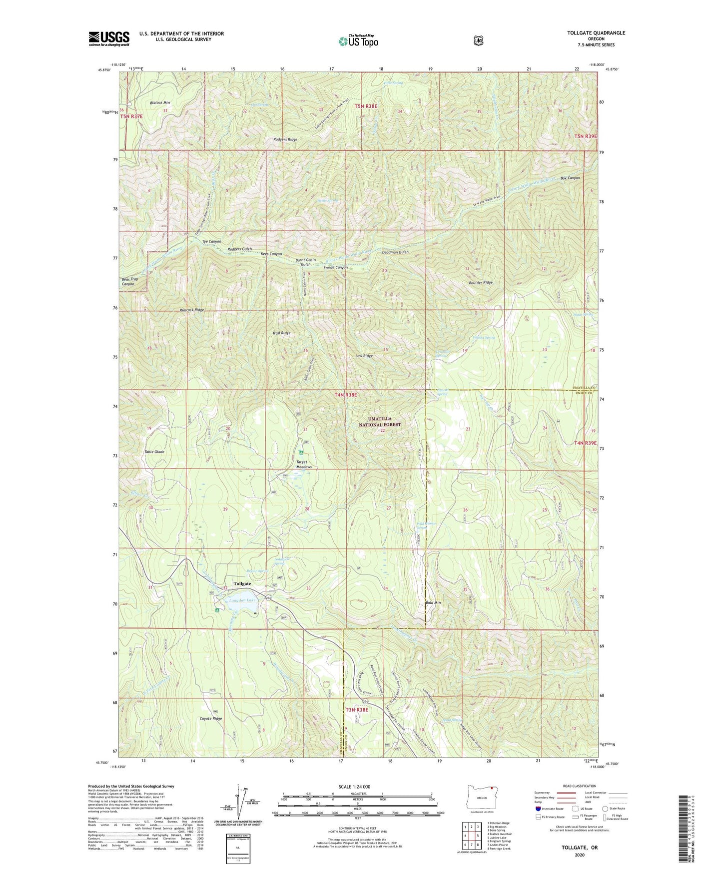
Tollgate Oregon US Topo Map
Couldn't load pickup availability
Also explore the Tollgate Forest Service Topo of this same quad for updated USFS data
2024 topographic map quadrangle Tollgate in the state of Oregon. Scale: 1:24000. Based on the newly updated USGS 7.5' US Topo map series, this map is in the following counties: Umatilla, Union. The map contains contour data, water features, and other items you are used to seeing on USGS maps, but also has updated roads and other features. This is the next generation of topographic maps. Printed on high-quality waterproof paper with UV fade-resistant inks.
Quads adjacent to this one:
West: Blalock Mountain
Northwest: Peterson Ridge
North: Big Meadows
Northeast: Bone Spring
East: Jubilee Lake
Southeast: Partridge Creek
South: Andies Prairie
Southwest: Bingham Springs
This map covers the same area as the classic USGS quad with code o45118g1.
Contains the following named places: Bald Mountain, Bear Creek, Bear Creek Guard Station, Bear Trap Canyon, Blue Mountain Lutheran Bible Camp, Boulder Ridge, Box Canyon, Bryson Spring, Burnt Cabin Gulch, Coyote Ridge, Cub Spring, Deadman Gulch, Deadman Spring, Gabriel Spring, Kees Canyon, Langdon Lake, Langdon Lake Dam, Lodgepole Spring, Low Ridge, McIntyre Lookout, Morning Creek, Rimrock Ridge, Rodgers Gulch, Rodgers Ridge, Skiphorton Creek, Spout Spring, Spout Springs Lookout Tower, Spout Springs Ski Area, Sugar Spring, Swamp Creek Corral, Swede Canyon, Swede Spring, Table Creek, Table Glade, Table Spring, Target Meadows, Target Meadows Campground, Tollgate, Tollgate Guard Station, Tollgate Post Office, Tollgate Work Camp, Tollgate Work Center, Trail Ridge, Tye Canyon, Whisky Spring, Wild Woman Spring, Woodward Recreation Site