MyTopo
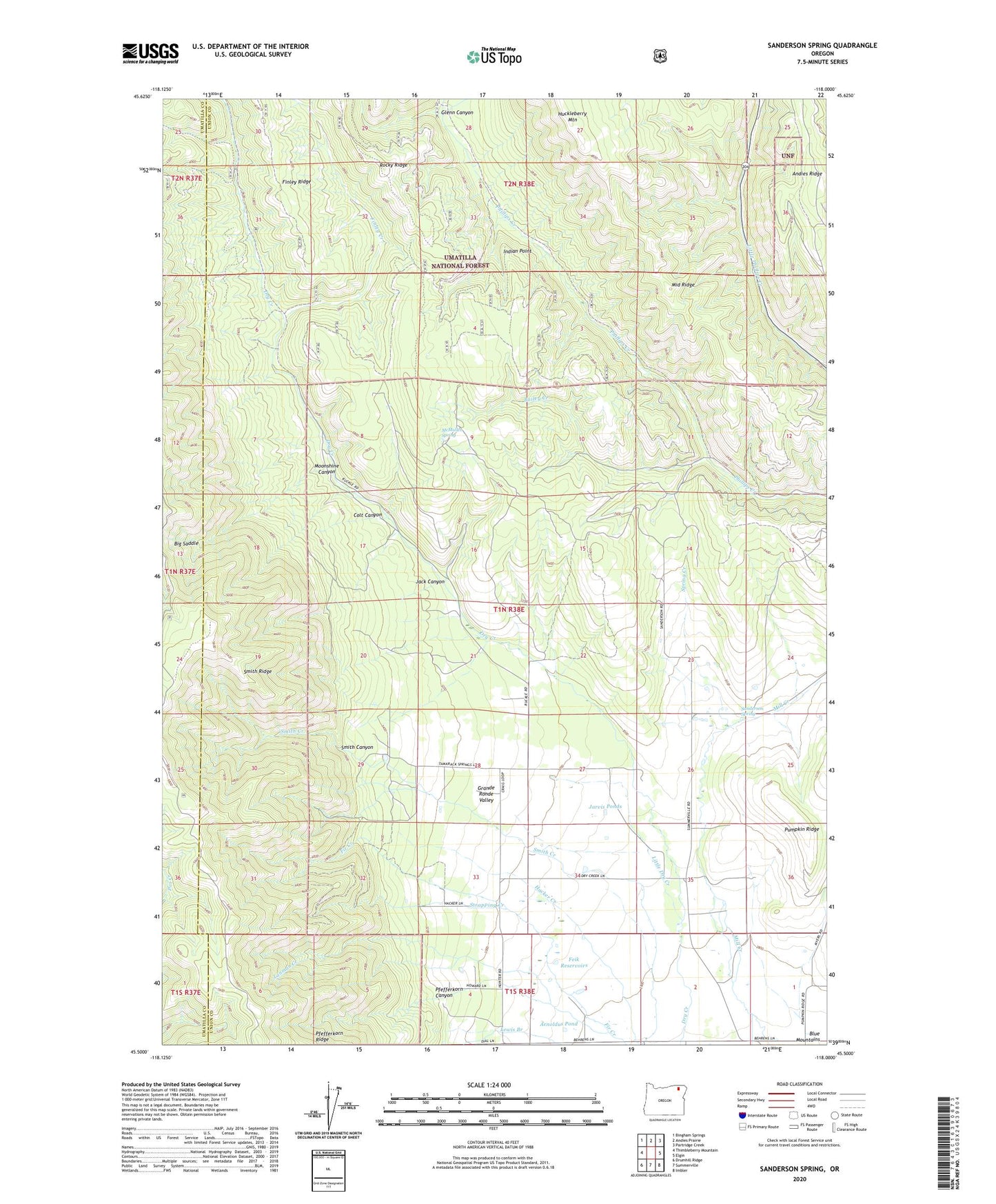
Sanderson Spring Oregon US Topo Map
Couldn't load pickup availability
Also explore the Sanderson Spring Forest Service Topo of this same quad for updated USFS data
2024 topographic map quadrangle Sanderson Spring in the state of Oregon. Scale: 1:24000. Based on the newly updated USGS 7.5' US Topo map series, this map is in the following counties: Union, Umatilla. The map contains contour data, water features, and other items you are used to seeing on USGS maps, but also has updated roads and other features. This is the next generation of topographic maps. Printed on high-quality waterproof paper with UV fade-resistant inks.
Quads adjacent to this one:
West: Thimbleberry Mountain
Northwest: Bingham Springs
North: Andies Prairie
Northeast: Partridge Creek
East: Elgin
Southeast: Imbler
South: Summerville
Southwest: Drumhill Ridge
This map covers the same area as the classic USGS quad with code o45118e1.
Contains the following named places: Arnoldus Pond, Bailey Creek, Big Saddle, Blue Mountains, Colt Canyon, Craigs Cabin, East Phillips Creek, Feik Reservoirs, Finley Creek, Finley Creek Cow Camp, Glenn Canyon, Huckleberry Mountain, Indian Point, Jack Canyon, Jarvis Ponds, Lanman Creek, Little Dry Creek, McMullen Spring, Moonshine Canyon, Pfefferkorn Canyon, Pfefferkorn Ridge, Sanderson Spring, Smith Canyon, Smith Ridge, Spring Creek, Stanley Cabin, Strapping Creek, ZIP Code: 97876