MyTopo
Boardman Oregon US Topo Map
Couldn't load pickup availability
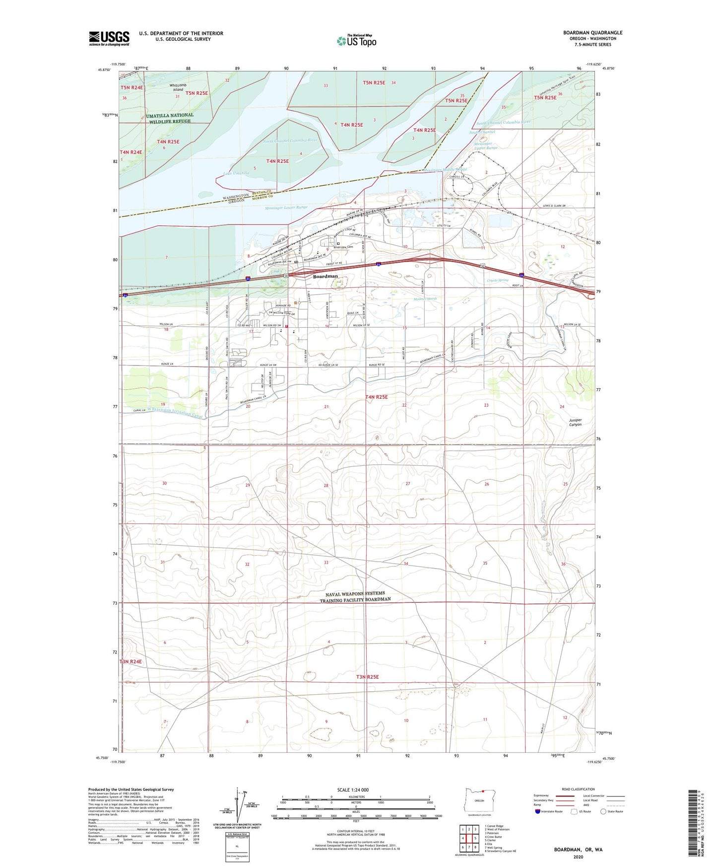
2020 topographic map quadrangle Boardman in the states of Oregon, Washington. Scale: 1:24000. Based on the newly updated USGS 7.5' US Topo map series, this map is in the following counties: Morrow, Benton. The map contains contour data, water features, and other items you are used to seeing on USGS maps, but also has updated roads and other features. This is the next generation of topographic maps. Printed on high-quality waterproof paper with UV fade-resistant inks.
Quads adjacent to this one:
West: Crow Butte
Northwest: Canoe Ridge
North: West of Paterson
Northeast: Paterson
East: Clarke
Southeast: Strawberry Canyon NE
South: Well Spring
Southwest: Ella
Contains the following named places: Boardman, Boardman City Hall, Boardman City Police Department, Boardman Division, Boardman Marina Park, Boardman Marina Park Boat Ramp, Boardman Post Office, Boardman Public Works Department, Boardman Rural Fire Protection District Station 1, Boardman Wastewater Treatment Plant, Boardman Water Treatment Plant, City of Boardman, Coyote, Coyote Island, Coyote Islands, Coyote Post Office, Coyote Spring, Coyote Springs Cogeneration Project, Faler Road Treaty Fishing Access Site, Juniper Canyon, Messinger Lower Range, Messinger Middle Range, Messinger Upper Range, Messner, Messner Marsh, Morrow County Health District Boardman Station, Oregon Trail Library District Boardman Library, Peters, Port of Morrow Harbor, Riverside Junior and Senior High School, Riverview Cemetery, Sam Boardman Elementary School, Whitcomb Island, Windy River Elementary School