MyTopo
Paterson Washington US Topo Map
Couldn't load pickup availability
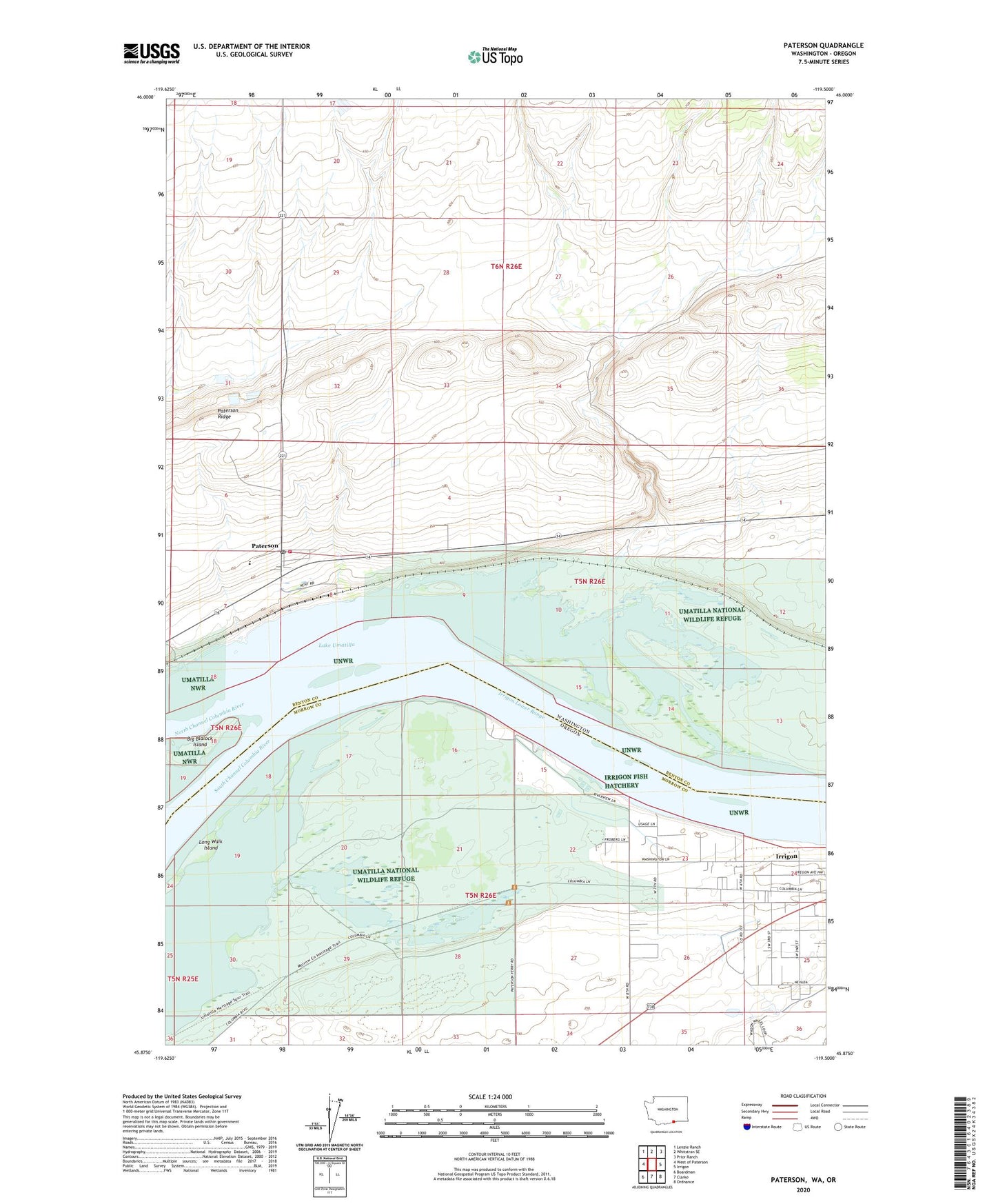
2023 topographic map quadrangle Paterson in the states of Washington, Oregon. Scale: 1:24000. Based on the newly updated USGS 7.5' US Topo map series, this map is in the following counties: Benton, Morrow. The map contains contour data, water features, and other items you are used to seeing on USGS maps, but also has updated roads and other features. This is the next generation of topographic maps. Printed on high-quality waterproof paper with UV fade-resistant inks.
Quads adjacent to this one:
West: West of Paterson
Northwest: Lenzie Ranch
North: Whitstran SE
Northeast: Prior Ranch
East: Irrigon
Southeast: Ordnance
South: Clarke
Southwest: Boardman
This map covers the same area as the classic USGS quad with code o45119h5.
Contains the following named places: Benton County Fire District 6, Big Blalock Island, Blalock Island, Columbia Crest Winery Airport, Cooks Island, Irrigon Cemetery, Irrigon Fish Hatchery, Irrigon Lower Range, Island Number 17, Island Number 18, John Day Wildlife Management Area, Judson, Long Walk Island, McCormack Slough, Monument Island, Number 18 Island, Paterson, Paterson Elementary School, Paterson Junction, Paterson Post Office, Paterson Ridge, Patterson Ferry Boat Ramp, Umatilla National Wildlife Refuge, ZIP Code: 97844