MyTopo
West of Paterson Washington US Topo Map
Couldn't load pickup availability
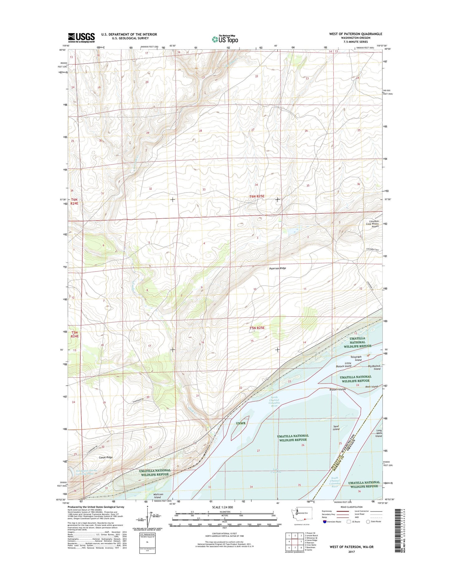
2023 topographic map quadrangle West of Paterson in the states of Washington, Oregon. Scale: 1:24000. Based on the newly updated USGS 7.5' US Topo map series, this map is in the following counties: Benton, Morrow. The map contains contour data, water features, and other items you are used to seeing on USGS maps, but also has updated roads and other features. This is the next generation of topographic maps. Printed on high-quality waterproof paper with UV fade-resistant inks.
Quads adjacent to this one:
West: Canoe Ridge
Northwest: Prosser SE
North: Lenzie Ranch
Northeast: Whitstran SE
East: Paterson
Southeast: Clarke
South: Boardman
Southwest: Crow Butte
This map covers the same area as the classic USGS quad with code o45119h6.
Contains the following named places: Blalock Islands, East Branch Glade Creek, Glade Creek, Little Blalock Island, North Channel Columbia River, Rock Island, Sage, Sand Island, Sandpiper Farms Leveling Pond, Sandpiper Farms Leveling Pond Dam, South Channel, South Channel Columbia River, Telegraph Island, ZIP Code: 99345