MyTopo
Brownsville Oregon US Topo Map
Couldn't load pickup availability
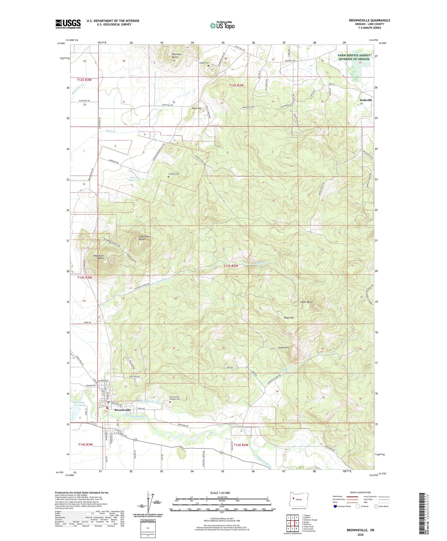
2020 topographic map quadrangle Brownsville in the state of Oregon. Scale: 1:24000. Based on the newly updated USGS 7.5' US Topo map series, this map is in the following counties: Linn. The map contains contour data, water features, and other items you are used to seeing on USGS maps, but also has updated roads and other features. This is the next generation of topographic maps. Printed on high-quality waterproof paper with UV fade-resistant inks.
Quads adjacent to this one:
West: Halsey
Northwest: Tangent
North: Lebanon
Northeast: Onehorse Slough
East: Waterloo
Southeast: Crawfordsville
South: Union Point
Southwest: Indian Head
Contains the following named places: Brownsville, Brownsville City Hall, Brownsville Community Library, Brownsville Dam, Brownsville Ditch, Brownsville Mennonite Church, Brownsville Municipal Court, Brownsville Pioneer Cemetery, Brownsville Post Office, Brownsville Public Works Department Office, Brownsville Rural Fire District 61, Brownsville Sewage Treatment Facility, Cedar Butte, City of Brownsville, Claypool Cemetery, Dodge Cemetery, Farm Service Agency Interest of Oregon, Kearns Reservoir, Lone Pine Butte, Robe Hill, Rock Hill, Schneider Log Pond, Snake Hill, Warren Creek, Washburn Butte, ZIP Code: 97327