MyTopo
Halsey Oregon US Topo Map
Couldn't load pickup availability
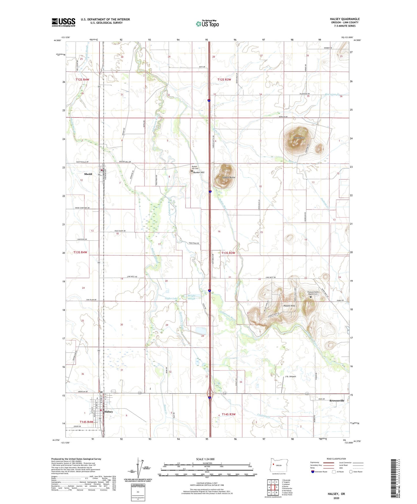
2023 topographic map quadrangle Halsey in the state of Oregon. Scale: 1:24000. Based on the newly updated USGS 7.5' US Topo map series, this map is in the following counties: Linn. The map contains contour data, water features, and other items you are used to seeing on USGS maps, but also has updated roads and other features. This is the next generation of topographic maps. Printed on high-quality waterproof paper with UV fade-resistant inks.
Quads adjacent to this one:
West: Peoria
Northwest: Riverside
North: Tangent
Northeast: Lebanon
East: Brownsville
Southeast: Union Point
South: Indian Head
Southwest: Harrisburg
This map covers the same area as the classic USGS quad with code o44123d1.
Contains the following named places: Boston Mills Post Office, Brownsville State Wayside, Bunker Hill, Bunker Hill Cemetery, Butte Creek, Central Linn Elementary School, Central Linn High School, City of Halsey, Cochran Creek, Courtney Creek, Halsey, Halsey - Shedd Rural Fire Protection District, Halsey - Shedd Rural Fire Protection District Station 51, Halsey City Hall, Halsey Municipal Court, Halsey Post Office, Halsey Public Works Department Office, J & J Airport, Linn, Memorial Park, Pioneer Villa Airstrip, Pioneer Villa Sewage Treatment Lagoon, Plainview, Plainview Creek, Plainview Post Office, Plainview School, Pleasant Butte Baptist Cemetery, Powell Hills, Saddle Butte, Shedd, Shedd Census Designated Place, Shedd Post Office, Sodom Dam, Sodom Ditch, Spoon Creek, Taylor Lake, Thompson Dam, Thompson's Mills State Heritage Site, Thompson's Mills State Park, Walton Slough, Ward Butte, Wright Slough, ZIP Codes: 97348, 97377