MyTopo
Indian Head Oregon US Topo Map
Couldn't load pickup availability
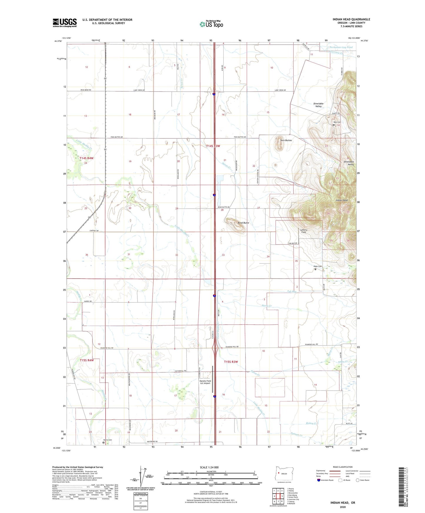
2023 topographic map quadrangle Indian Head in the state of Oregon. Scale: 1:24000. Based on the newly updated USGS 7.5' US Topo map series, this map is in the following counties: Linn. The map contains contour data, water features, and other items you are used to seeing on USGS maps, but also has updated roads and other features. This is the next generation of topographic maps. Printed on high-quality waterproof paper with UV fade-resistant inks.
Quads adjacent to this one:
West: Harrisburg
Northwest: Peoria
North: Halsey
Northeast: Brownsville
East: Union Point
Southeast: Mohawk
South: Coburg
Southwest: Junction City
This map covers the same area as the classic USGS quad with code o44123c1.
Contains the following named places: Bishop Creek, Blan Cemetery, Bond Butte, Brownsville Wastewater Treatment Facility, Charity Grange Hall, Crocus, Daniels Field LLC Airport, Dinwiddie Valley, Folk, Harris Cemetery, Harris Private School, Indian Head, Lafferty Field, Permaneer Log Pond, Pierce Creek, Putnam Creek, River Spur, Rowland, Rowland Post Office, Stanwood, Tub Run, Twin Buttes, Virgil, White Creek, Wigle Cemetery, Wrights Airfield, ZIP Code: 97446