
MyTopo
Bulger Ridge Oregon US Topo Map
Couldn't load pickup availability
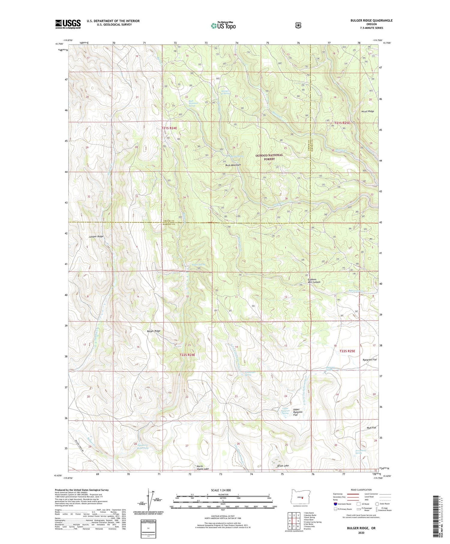
2020 topographic map quadrangle Bulger Ridge in the state of Oregon. Scale: 1:24000. Based on the newly updated USGS 7.5' US Topo map series, this map is in the following counties: Harney, Crook. The map contains contour data, water features, and other items you are used to seeing on USGS maps, but also has updated roads and other features. This is the next generation of topographic maps. Printed on high-quality waterproof paper with UV fade-resistant inks.
Quads adjacent to this one:
West: Dust Bowl
Northwest: Ibex Butte
North: Mackey Butte
Northeast: Buck Spring
East: Camp Currey Spring
Southeast: Suntex
South: Potato Hills
Southwest: Hat Butte
Contains the following named places: Arrowhead Spring, Brush Lake, Buck Mountain, Buck Mountain Spring, Bulger Ridge, Bulger Spring, Cecil Reservoir, Freshwater Spring, Gibbons Mill Canyon, Hillside Reservoir, Jacks Camp, Jacks Camp Reservoir, Juniper Hill Ranch, Juniper Ridge, Meadow Reservoir, North Sheep Lake, Pats Reservoir, Ryegrass Flat, Ryegrass Reservoir, Ryegrass Spring, Sawlog Spring, Shangri-la Spring, Spencer Reservoir, Spencers Waterhole, Swamp Creek Dam, Swamp Creek Reservoir, Upper Ryegrass Flat, Upper Ryegrass Spring


