MyTopo
Ibex Butte Oregon US Topo Map
Couldn't load pickup availability
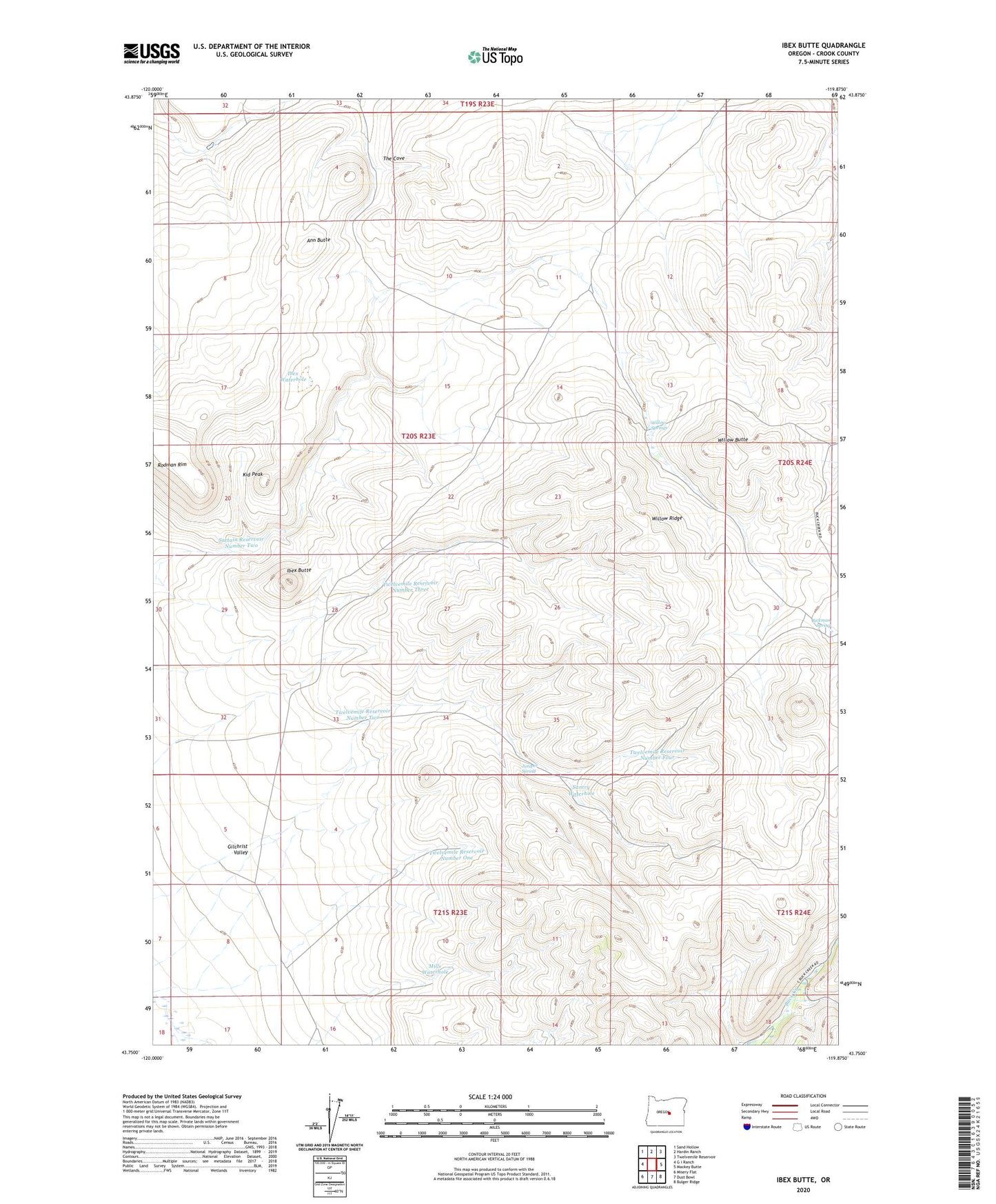
2023 topographic map quadrangle Ibex Butte in the state of Oregon. Scale: 1:24000. Based on the newly updated USGS 7.5' US Topo map series, this map is in the following counties: Crook. The map contains contour data, water features, and other items you are used to seeing on USGS maps, but also has updated roads and other features. This is the next generation of topographic maps. Printed on high-quality waterproof paper with UV fade-resistant inks.
Quads adjacent to this one:
West: G I Ranch
Northwest: Sand Hollow
North: Hardin Ranch
Northeast: Twelvemile Reservoir
East: Mackey Butte
Southeast: Bulger Ridge
South: Dust Bowl
Southwest: Misery Flat
This map covers the same area as the classic USGS quad with code o43119g8.
Contains the following named places: Ann Butte, Ibex Butte, Ibex Waterhole, Juniper Spring, Kid Peak, Mills Waterhole, Rickman Spring, Santry Waterhole, Sartain Reservoir Number Two, Sera Well, The Cove, Twelvemile Reservoir Number Four, Twelvemile Reservoir Number One, Twelvemile Reservoir Number Three, Twelvemile Reservoir Number Two, Willow Butte, Willow Ridge, Willow Springs