MyTopo
Dust Bowl Oregon US Topo Map
Couldn't load pickup availability
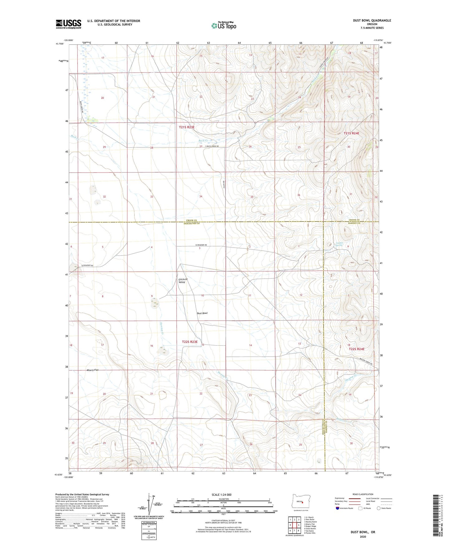
2023 topographic map quadrangle Dust Bowl in the state of Oregon. Scale: 1:24000. Based on the newly updated USGS 7.5' US Topo map series, this map is in the following counties: Crook, Deschutes, Harney. The map contains contour data, water features, and other items you are used to seeing on USGS maps, but also has updated roads and other features. This is the next generation of topographic maps. Printed on high-quality waterproof paper with UV fade-resistant inks.
Quads adjacent to this one:
West: Misery Flat
Northwest: G I Ranch
North: Ibex Butte
Northeast: Mackey Butte
East: Bulger Ridge
Southeast: Potato Hills
South: Hat Butte
Southwest: Glass Buttes
This map covers the same area as the classic USGS quad with code o43119f8.
Contains the following named places: Barney Ranch, Bulger Creek, Dust Bowl, Fife Post Office, Juniper Spring, Misery Flat, Swamp Creek, Verges Ranch