MyTopo
Bull of the Woods Oregon US Topo Map
Couldn't load pickup availability
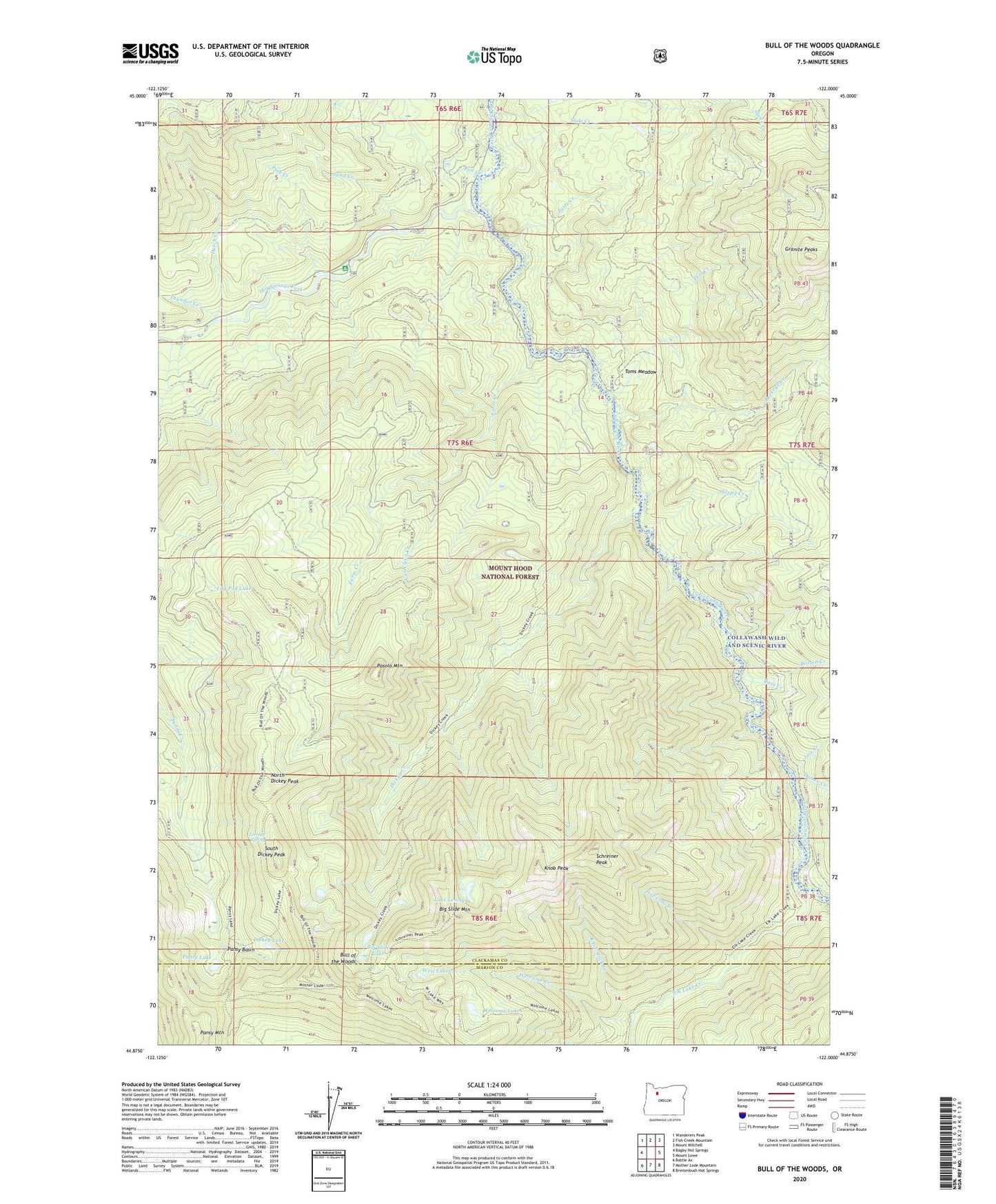
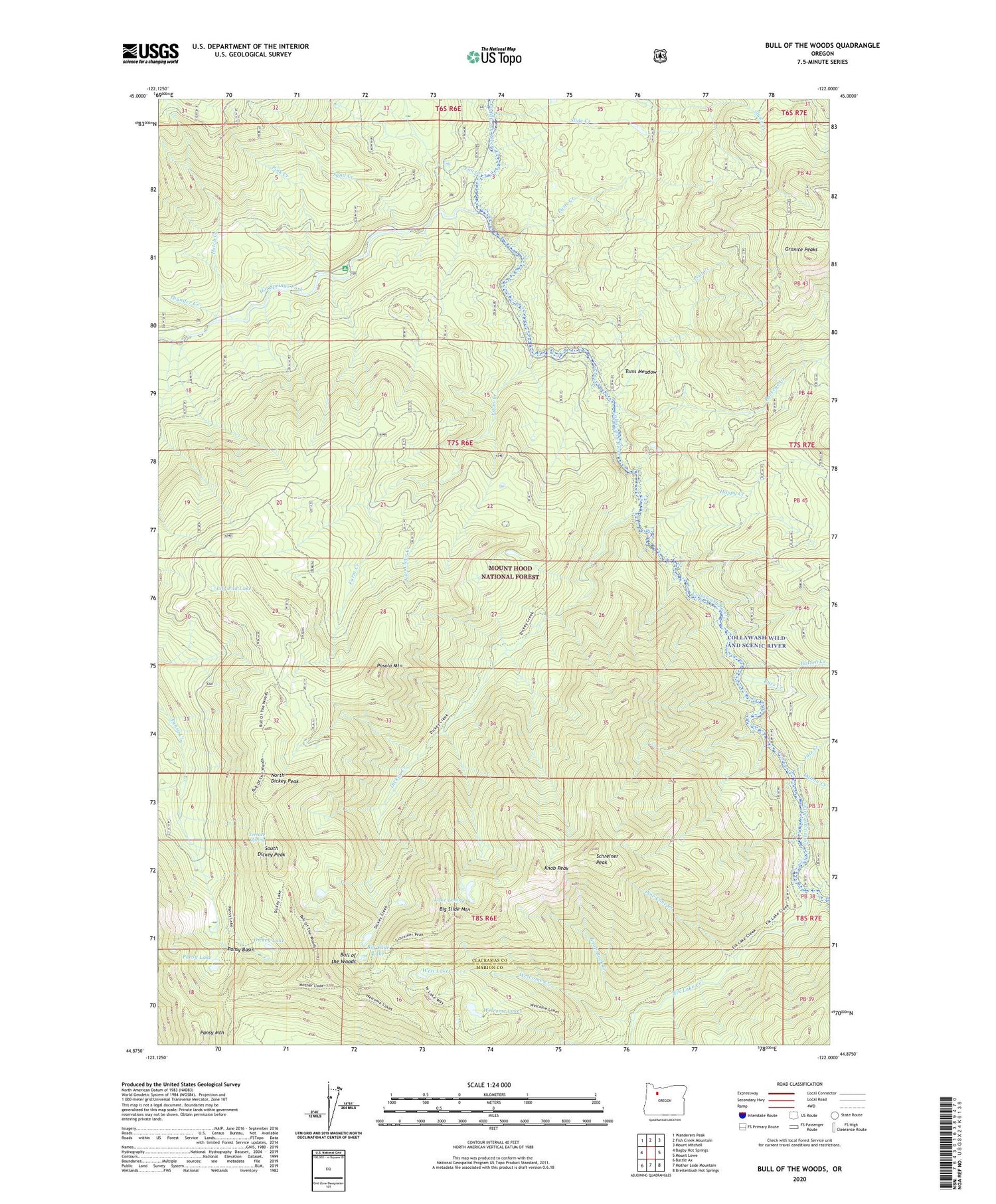
2020 topographic map quadrangle Bull of the Woods in the state of Oregon. Scale: 1:24000. Based on the newly updated USGS 7.5' US Topo map series, this map is in the following counties: Clackamas, Marion. The map contains contour data, water features, and other items you are used to seeing on USGS maps, but also has updated roads and other features. This is the next generation of topographic maps. Printed on high-quality waterproof paper with UV fade-resistant inks.
Quads adjacent to this one:
West: Bagby Hot Springs
Northwest: Wanderers Peak
North: Fish Creek Mountain
Northeast: Mount Mitchell
East: Mount Lowe
Southeast: Breitenbush Hot Springs
South: Mother Lode Mountain
Southwest: Battle Ax
Contains the following named places: Alder Swamp Shelter, Bagby Trail, Big Slide Lake, Big Slide Mountain, Blitzen Creek, Buckeye Creek, Bull of the Woods, Bull of the Woods Trail, Bull of the Woods Wilderness, Calog Quarry, Cat Creek, Collawash Wild and Scenic River, Dickey Creek, Dickey Lake, Dunno Creek, Dutch Creek, Dutch Creek Shelter, East Fork Collawash River, Elk Lake Creek, Fan Creek, Farm Creek, Farm Trail, Happy Creek, Happy Quarry, Hot Springs Fork, Jazz Creek, Kingfisher Recreation Site, Knob Peak, Knob Rock Creek, Lake Lenore, Lily Pad Lake, Lily Pad Quarry, Little Fan Creek Campground, North Dickey Peak, Ogre Creek, Oh Boy Forest Camp, Pansy Basin, Pansy Lake, Pansy Mountain, Pasola Mountain, Paste Creek, Peat Creek, Pine Cone Creek, Pink Creek, Russ Creek, Russ Creek Quarry, Sand Creek, Schreiner Peak, Slide Creek, South Dickey Peak, Terrace Spring, Thunder Creek, Thunder Mountain Trail, Toms Meadow, Van Cleve Creek, Welcome Creek, Welcome Lakes, Welcome Lakes Trail, West Lake