MyTopo
Bagby Hot Springs Oregon US Topo Map
Couldn't load pickup availability
Also explore the Bagby Hot Springs Forest Service Topo of this same quad for updated USFS data
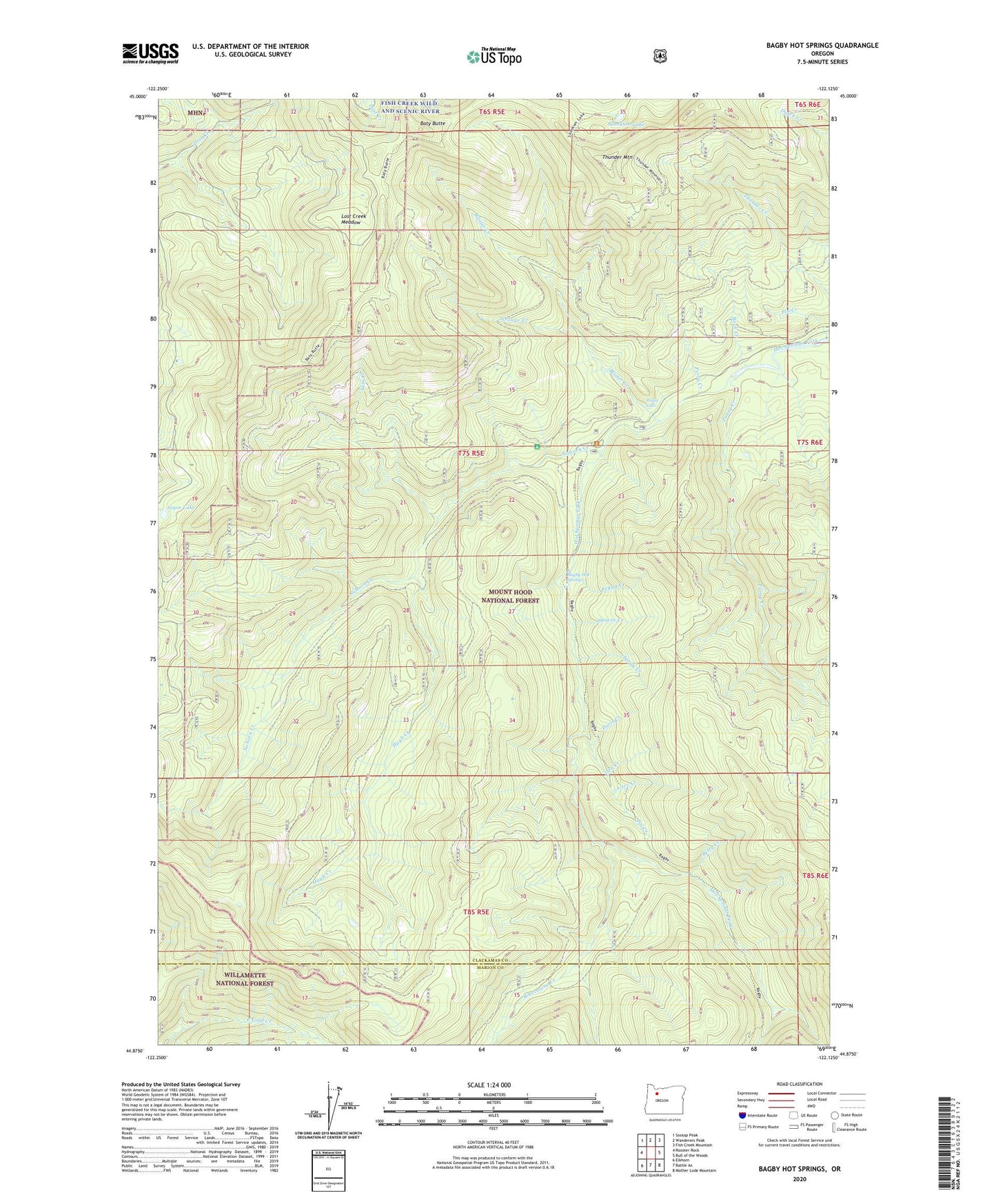
2023 topographic map quadrangle Bagby Hot Springs in the state of Oregon. Scale: 1:24000. Based on the newly updated USGS 7.5' US Topo map series, this map is in the following counties: Clackamas, Marion. The map contains contour data, water features, and other items you are used to seeing on USGS maps, but also has updated roads and other features. This is the next generation of topographic maps. Printed on high-quality waterproof paper with UV fade-resistant inks.
Quads adjacent to this one:
West: Rooster Rock
Northwest: Soosap Peak
North: Wanderers Peak
Northeast: Fish Creek Mountain
East: Bull of the Woods
Southeast: Mother Lode Mountain
South: Battle Ax
Southwest: Elkhorn
This map covers the same area as the classic USGS quad with code o44122h2.
Contains the following named places: Alice Creek, Bagby Hot Springs, Bagby Hot Springs Guard Station, Bagby Hot Springs Recreation Site, Bagby Natural Research Area, Baty Butte, Baty Silver King Trail, Betty Creek, Blister Creek, Doris Creek, East Mountain Trail, Hugh Creek, Hugh Creek Quarry, Hughs Horse Gravel Pit, Joyce Lake, Lost Creek Meadow, Molalla Trail, Nohorn Creek, Nohorn Trail, Opal Creek Wilderness, Ora Creek, Pal Creek, Pansy Creek, Peggy Creek, Pegleg Falls, Pegleg Falls Recreation Site, Perry Creek, Pin Creek, Rock Creek, Shower Creek, Skin Creek, Skookum Lake, Skookum Lake Campground, South Fork Mountain Trail, Spray Creek, Stroupe Creek, Stroupe Creek Quarry, Thunder Mountain, Whetstone Creek, Whetstone Trail