MyTopo
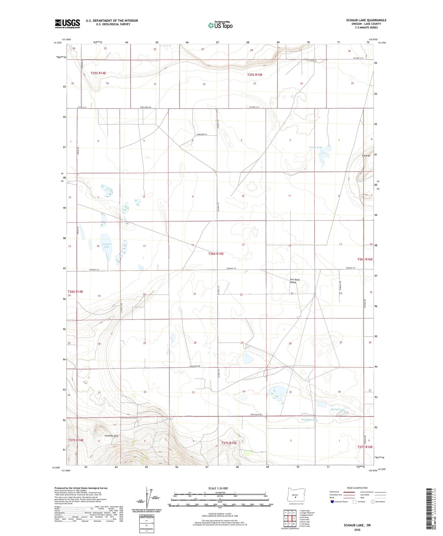
Schaub Lake Oregon US Topo Map
Couldn't load pickup availability
2023 topographic map quadrangle Schaub Lake in the state of Oregon. Scale: 1:24000. Based on the newly updated USGS 7.5' US Topo map series, this map is in the following counties: Lake. The map contains contour data, water features, and other items you are used to seeing on USGS maps, but also has updated roads and other features. This is the next generation of topographic maps. Printed on high-quality waterproof paper with UV fade-resistant inks.
Quads adjacent to this one:
West: Fort Rock
Northwest: Cabin Lake
North: Cougar Mountain
Northeast: Hogback Butte
East: Lane Lake
Southeast: Thorn Lake
South: Tuff Butte
Southwest: Silver Lake
This map covers the same area as the classic USGS quad with code o43120c8.
Contains the following named places: Boley Ranch, Connley, Connley Post Office, Cream Lake, Dog Lake, Eskelin Ranch, Fort Rock Valley, McCall Lake, Miles Ranch, Morehouse Ranch, Owen Pitcher Ranch, Parks Ranch, Pitcher Ranch, Poplars Ranch, R Morehouse Place, Schaub Lake, Windmill Lake, Woodrow, Woodrow Post Office