MyTopo
Cave Junction Oregon US Topo Map
Couldn't load pickup availability
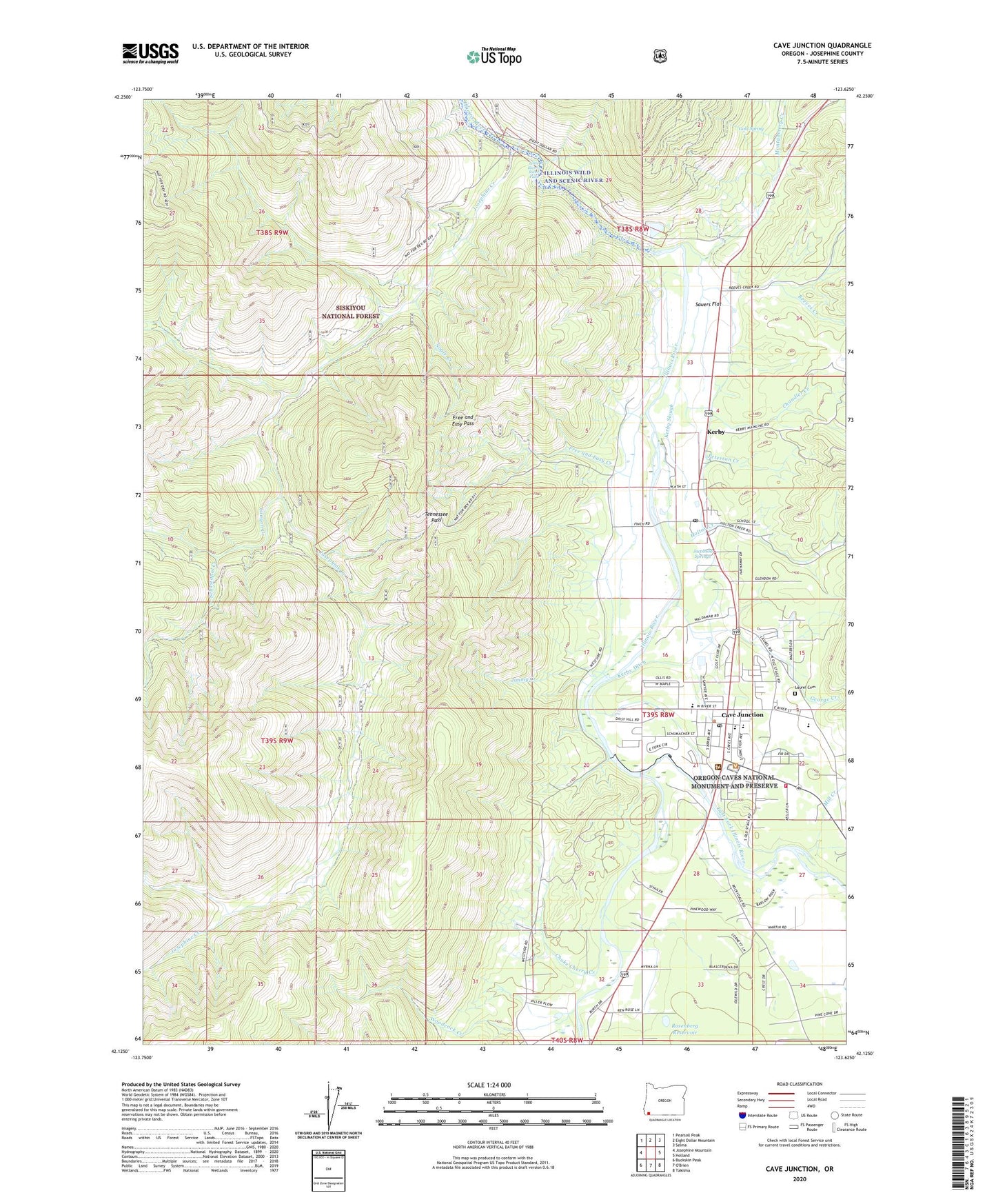
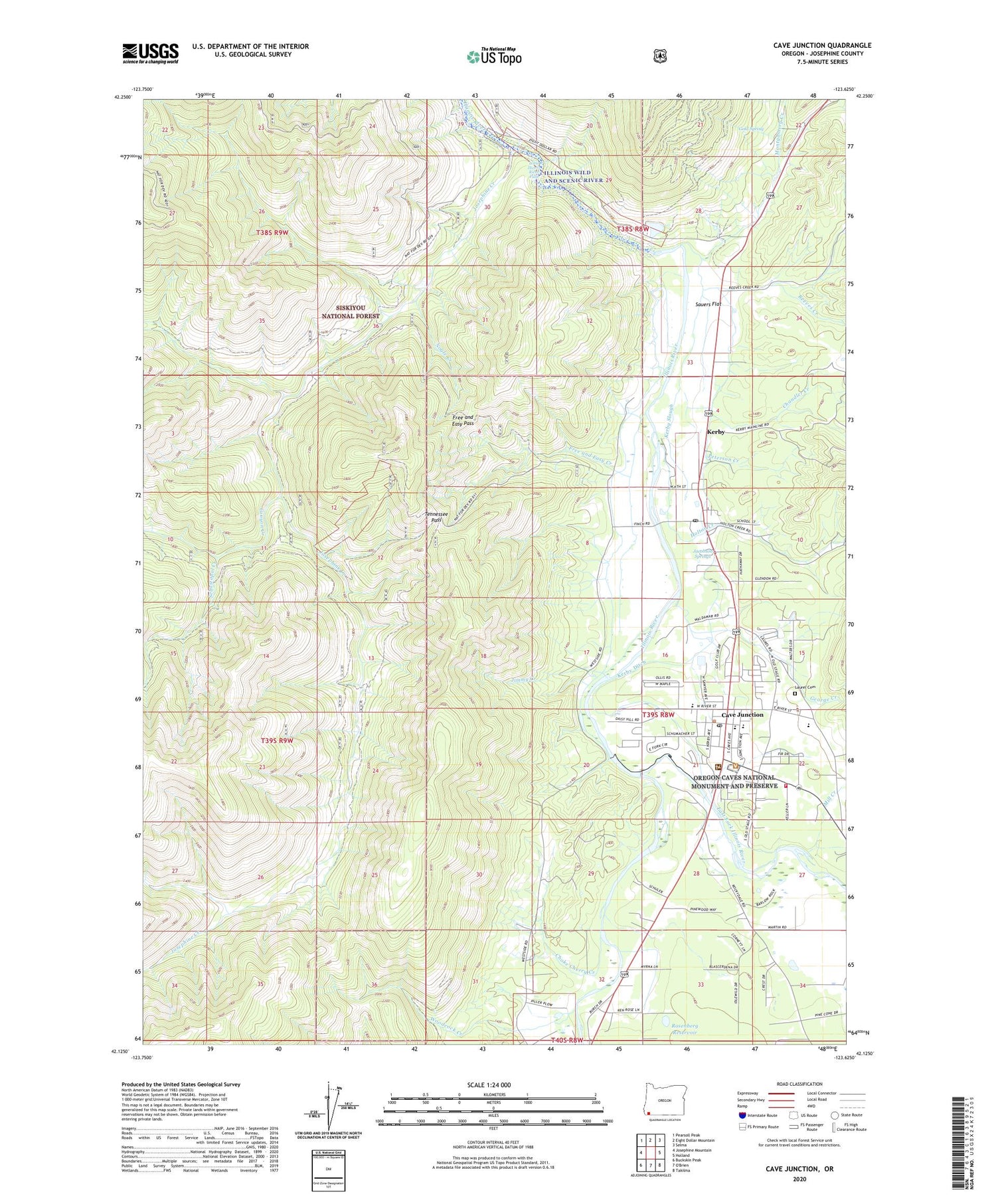
2020 topographic map quadrangle Cave Junction in the state of Oregon. Scale: 1:24000. Based on the newly updated USGS 7.5' US Topo map series, this map is in the following counties: Josephine. The map contains contour data, water features, and other items you are used to seeing on USGS maps, but also has updated roads and other features. This is the next generation of topographic maps. Printed on high-quality waterproof paper with UV fade-resistant inks.
Quads adjacent to this one:
West: Josephine Mountain
Northwest: Pearsoll Peak
North: Eight Dollar Mountain
Northeast: Selma
East: Holland
Southeast: Takilma
South: O'Brien
Southwest: Buckskin Peak
Contains the following named places: Bacus Creek, Calvert Slough, Camp Creek, Canyon Creek, Canyon Gulch, Cave Junction, Cave Junction City Hall, Cave Junction Municipal Court, Cave Junction Post Office, Cave Junction Public Works, Cave Junction Wastewater Sewage Treatment, Cave Junction Water Treatment Plant, Chandler Creek, Choke Cherry Creek, City of Cave Junction, Days Gulch, Department of Motor Vehicles Cave Junction, East Fork Illinois River, Evergreen Elementary School, Fiddler Gulch, Free and Easy Creek, Free and Easy Pass, Frost Gulch, George Creek, Gold Spring, Holton Creek, Illinois River Forks State Park, Illinois Valley Fire District Station 1, Illinois Valley High School, Jacobson Springs, Jimmy Creek, Josephine Creek, Kerby, Kerby Census Designated Place, Kerby Ditch, Kerby Post Office, Kerby Slough, Kerbyville Museum, KIVR-AM, Laurel Cemetery, Little Illinois River Falls, Lorna Byrne Middle School, Lynholm Gulch, Madison Gulch, Meadow Creek Campground, Mill Creek, Montgomery Creek, Nogle Creek, Peterson Creek, Pomeroy Dam, Reeves Creek, Rosenberg Reservoir, Sauers Creek, Sauers Flat, Sebastopol Creek, South Fork Fiddler Gulch, Sugar Gulch, Tennessee Gulch, Tennessee Mountain, Tennessee Pass, West Fork Illinois River, Wild Rivers Ranger District - Cave Junction, Woodcock Creek, Woodcock Mountain, ZIP Code: 97531