MyTopo
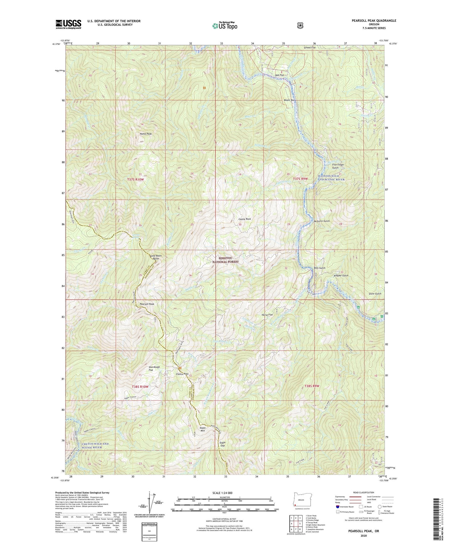
Pearsoll Peak Oregon US Topo Map
Couldn't load pickup availability
Also explore the Pearsoll Peak Forest Service Topo of this same quad for updated USFS data
2023 topographic map quadrangle Pearsoll Peak in the state of Oregon. Scale: 1:24000. Based on the newly updated USGS 7.5' US Topo map series, this map is in the following counties: Josephine, Curry. The map contains contour data, water features, and other items you are used to seeing on USGS maps, but also has updated roads and other features. This is the next generation of topographic maps. Printed on high-quality waterproof paper with UV fade-resistant inks.
Quads adjacent to this one:
West: Tincup Peak
Northwest: Silver Peak
North: York Butte
Northeast: Chrome Ridge
East: Eight Dollar Mountain
Southeast: Cave Junction
South: Josephine Mountain
Southwest: Chetco Peak
This map covers the same area as the classic USGS quad with code o42123c7.
Contains the following named places: Albright Mine, Babyfoot Creek, Baker Creek, Bills Gulch, Bowser Mine, Castle Rock, Chetco Pass, Chetco Pass Creek, Chrome King Mine, Cox Mine, Crater Creek, Dailey Creek, Deep Gorge Mine, Eagle Gap, Eagle Mountain, Eagles Nest Mine, Eureka Mine, Fall Creek, Fall Creek Copper Mine, Five Finger Gulch, Gold Basin Butte, Golden Dreams Mine, Golden Eagle Mine, Granite Spring, Hall Cabin, Horse Flat, Hustis Mine, Knapke Gulch, Labrador Creek, Lightning Creek, Little Siberia Mine, Marsh Creek, McCaleb Ranch, McGuire Gulch, Miami Bar, Miami Bar Boat Launch, Mill Creek, Miller Creek, Myrtle Creek, Nome Creek, Nome Peak, Oak Flat, Oak Flat Creek, O'Conner Creek, Pearsoll Creek, Pearsoll Mine, Pearsoll Peak, Peck Mine, Rancherie Creek, Robertson Mine, Salmon Creek, School Flat, Slide Creek, Sourdough Flat, Store Gulch, Store Gulch Guard Station, Store Gulch Recreation Site, Telephone Creek, Twin Cedars Creek, Uncle Sam Mine, West Fork Rancherie Creek