MyTopo
Chicken Spring Oregon US Topo Map
Couldn't load pickup availability
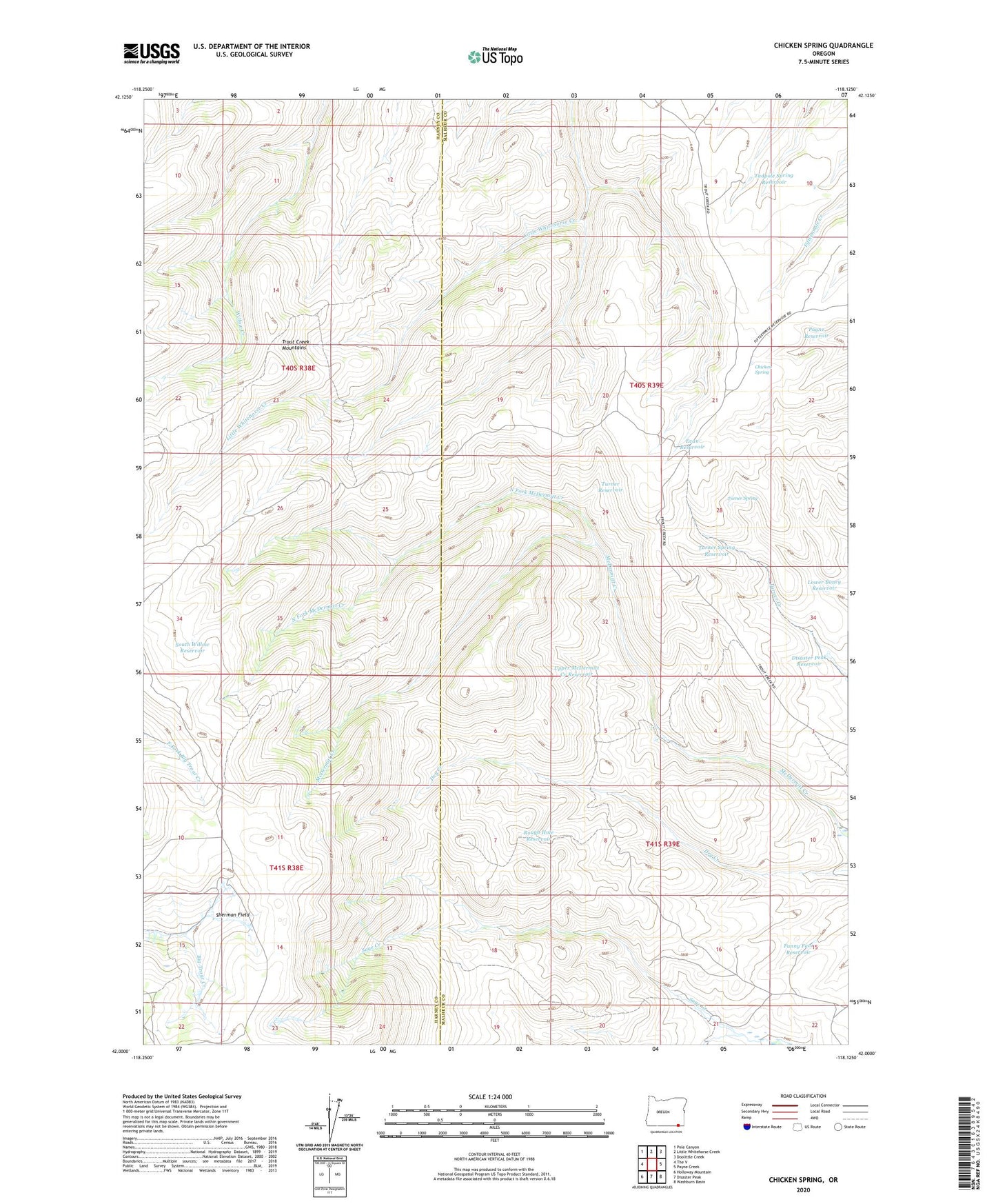
2023 topographic map quadrangle Chicken Spring in the state of Oregon. Scale: 1:24000. Based on the newly updated USGS 7.5' US Topo map series, this map is in the following counties: Harney, Malheur. The map contains contour data, water features, and other items you are used to seeing on USGS maps, but also has updated roads and other features. This is the next generation of topographic maps. Printed on high-quality waterproof paper with UV fade-resistant inks.
Quads adjacent to this one:
West: The V
Northwest: Pole Canyon
North: Little Whitehorse Creek
Northeast: Doolittle Creek
East: Payne Creek
Southeast: Washburn Basin
South: Disaster Peak
Southwest: Holloway Mountain
This map covers the same area as the classic USGS quad with code o42118a2.
Contains the following named places: Chicken Spring, Disaster Peak Reservoir, Evan Reservoir, Funny Face Reservoir, Lower Boney Reservoir, North Fork McDermitt Creek, Payne Reservoir, Rough Hole Reservoir, Sherman Field, South Willow Reservoir, Tadpole Spring Reservoir, Turner Reservoir, Turner Spring, Turner Spring Reservoir, Upper McDermitt Creek Reservoir