MyTopo
Doolittle Creek Oregon US Topo Map
Couldn't load pickup availability
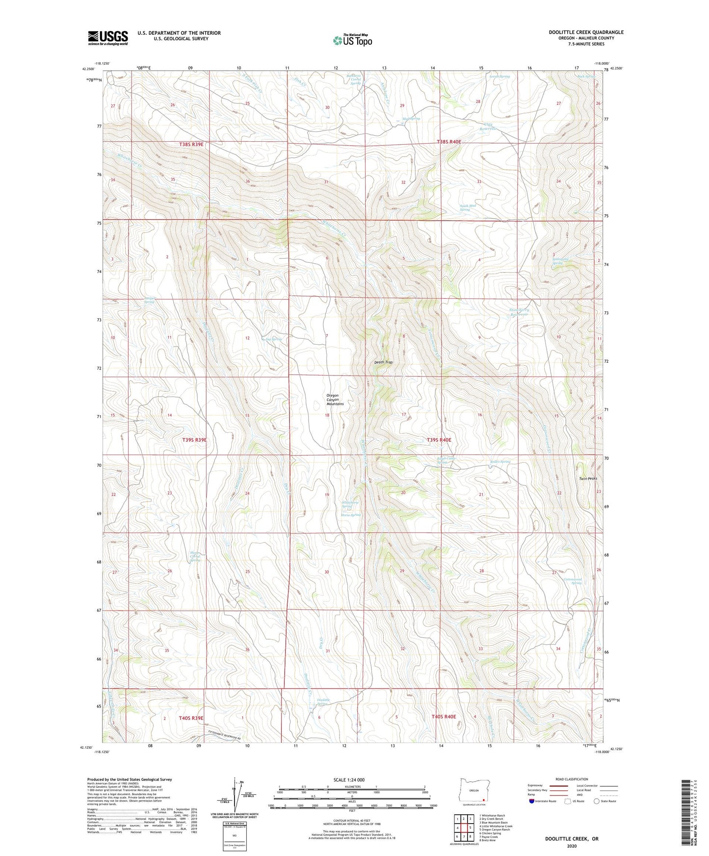
2023 topographic map quadrangle Doolittle Creek in the state of Oregon. Scale: 1:24000. Based on the newly updated USGS 7.5' US Topo map series, this map is in the following counties: Malheur. The map contains contour data, water features, and other items you are used to seeing on USGS maps, but also has updated roads and other features. This is the next generation of topographic maps. Printed on high-quality waterproof paper with UV fade-resistant inks.
Quads adjacent to this one:
West: Little Whitehorse Creek
Northwest: Whitehorse Ranch
North: Dry Creek Bench
Northeast: Blue Mountain Basin
East: Oregon Canyon Ranch
Southeast: Bretz Mine
South: Payne Creek
Southwest: Chicken Spring
This map covers the same area as the classic USGS quad with code o42118b1.
Contains the following named places: Buck Spring, Buckaroo Corral Spring, Clay Reservoir, Cottonwood Creek, Cottonwood Spring, Death Trap, Doolittle Camp, Doolittle Creek, Doolittle Spring, Dry Creek, Horse Spring, Jug Spring, Juniper Spring, Locust Spring, Mahogany Spring, Minehole Creek, Mud Spring, Ralph Camp Spring, Rodeo Spring, Sheep Corral Spring, Snowberry Reservoir, South Mud Spring, Twin Peaks, Whitehorse Spring