MyTopo
Davis Mountain Oregon US Topo Map
Couldn't load pickup availability
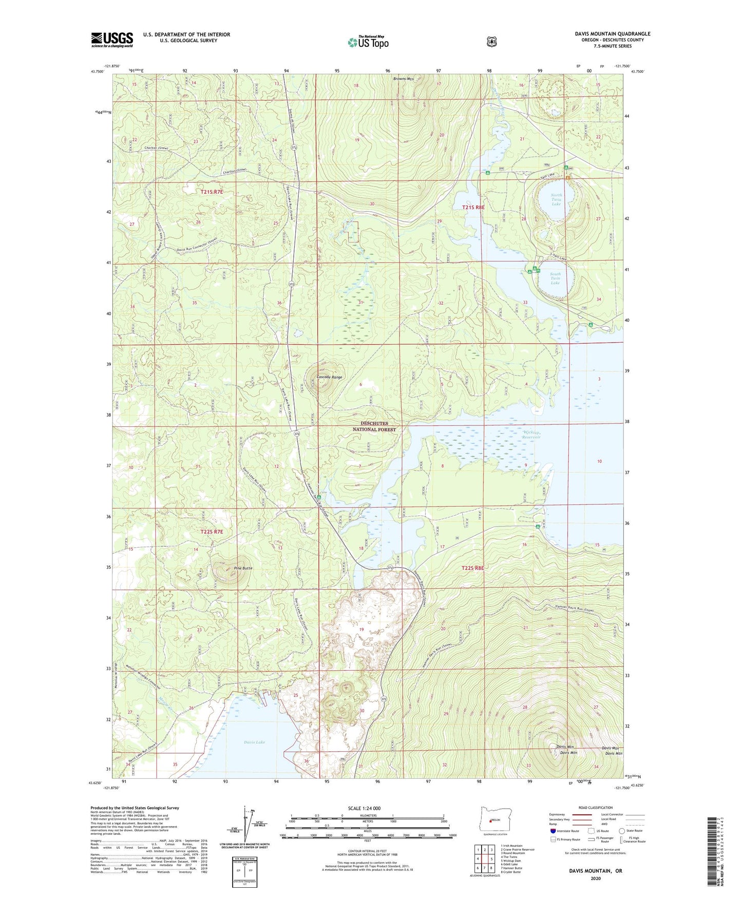
2020 topographic map quadrangle Davis Mountain in the state of Oregon. Scale: 1:24000. Based on the newly updated USGS 7.5' US Topo map series, this map is in the following counties: Deschutes. The map contains contour data, water features, and other items you are used to seeing on USGS maps, but also has updated roads and other features. This is the next generation of topographic maps. Printed on high-quality waterproof paper with UV fade-resistant inks.
Quads adjacent to this one:
West: The Twins
Northwest: Irish Mountain
North: Crane Prairie Reservoir
Northeast: Round Mountain
East: Wickiup Dam
Southeast: Cryder Butte
South: Hamner Butte
Southwest: Odell Lake
Contains the following named places: Browns Creek, Browns Mountain, Browns Mountain Crossing, Browns Mountain Recreation Site, Davis Mountain, Gull Point Campground Boat Ramp, Gull Point Recreation Site, Moore Creek, North Davis Creek, North Davis Creek Boat Launch, North Davis Creek Recreation Site, North Twin Lake, North Twin Lake Campground Boat Ramp, North Twin Recreation Site, North Wickiup Campground, North Wickiup Reservoir Boat Ramp, Pine Butte, Reservoir Campground Boat Launch, Reservoir Recreation Site, Sheep Bridge Recreation Site, Sheeps Bridge Boat Launch, South Twin Lake, South Twin Lake Boat Launch, South Twin Recreation Site, Twin Lakes, West South Twin Recreation Site