MyTopo
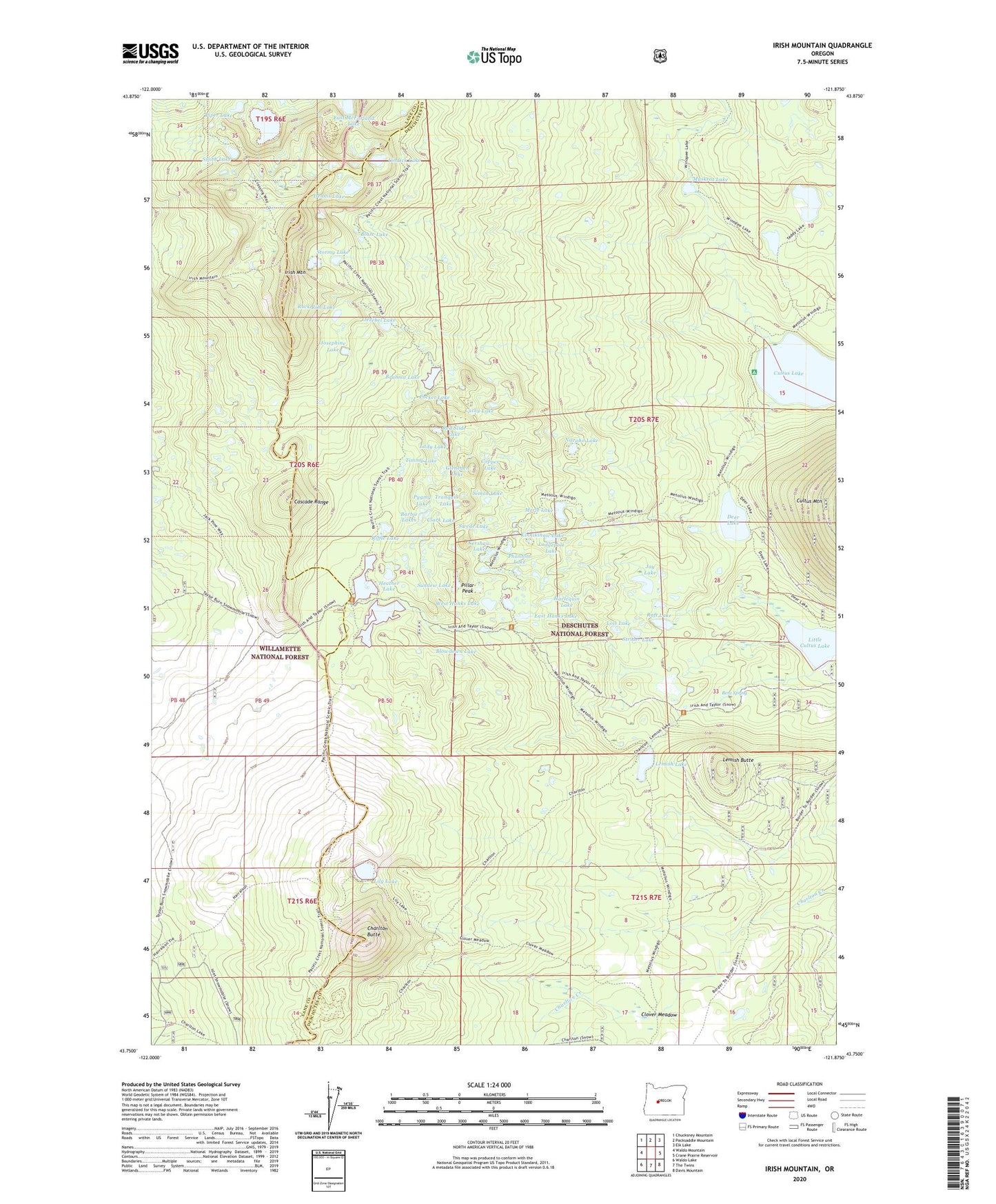
Irish Mountain Oregon US Topo Map
Couldn't load pickup availability
Also explore the Irish Mountain Forest Service Topo of this same quad for updated USFS data
2023 topographic map quadrangle Irish Mountain in the state of Oregon. Scale: 1:24000. Based on the newly updated USGS 7.5' US Topo map series, this map is in the following counties: Deschutes, Lane. The map contains contour data, water features, and other items you are used to seeing on USGS maps, but also has updated roads and other features. This is the next generation of topographic maps. Printed on high-quality waterproof paper with UV fade-resistant inks.
Quads adjacent to this one:
West: Waldo Mountain
Northwest: Chucksney Mountain
North: Packsaddle Mountain
Northeast: Elk Lake
East: Crane Prairie Reservoir
Southeast: Davis Mountain
South: The Twins
Southwest: Waldo Lake
This map covers the same area as the classic USGS quad with code o43121g8.
Contains the following named places: Barbie Lakes, Benz Spring, Blaze Lake, Blowdown Lake, Brahma Lake, Cathy Lake, Charlton Butte, Clark Lake, Clover Meadow, Copper Lake, Crossing Way, Deer Lake, Dennis Lake, East Hanks Lake, East McFarland Lake, Gleneden Lake, Harlequin Lake, Harralson Horse Camp, Heather Lake, Irish and Taylor Recreation Site, Irish Lake, Irish Mountain, Jay Lake, Jezebel Lake, Josephine Lake, Kershaw Lake, Kinnikinnic Lake, Lady Lake, Lemish Butte, Lemish Lake, Lily Lake, Lindick Lake, Lodgepole Lake, Lois Lake, McFarland Lake, Merle Lake, Middle Hanks Lake, Muskrat Lake, Navaho Lake, Phantom Lake, Pillar Peak, Piper Lake, Pocket Lake, Pygmy Lake, Raft Lake, Red Slide Lake, Riffle Lake, Rock Rim Lake, Simon Lake, Smith Lake, Stormy Lake, Strider Lake, Sundew Lake, Swede Lake, Taylor Lake, Teddy Lakes, Timmy Lake, Tranquil Lake, West Cultus Lake Recreation Site, West Hanks Lake, Winopee Lake Trail