
MyTopo
Delintment Lake Oregon US Topo Map
Couldn't load pickup availability
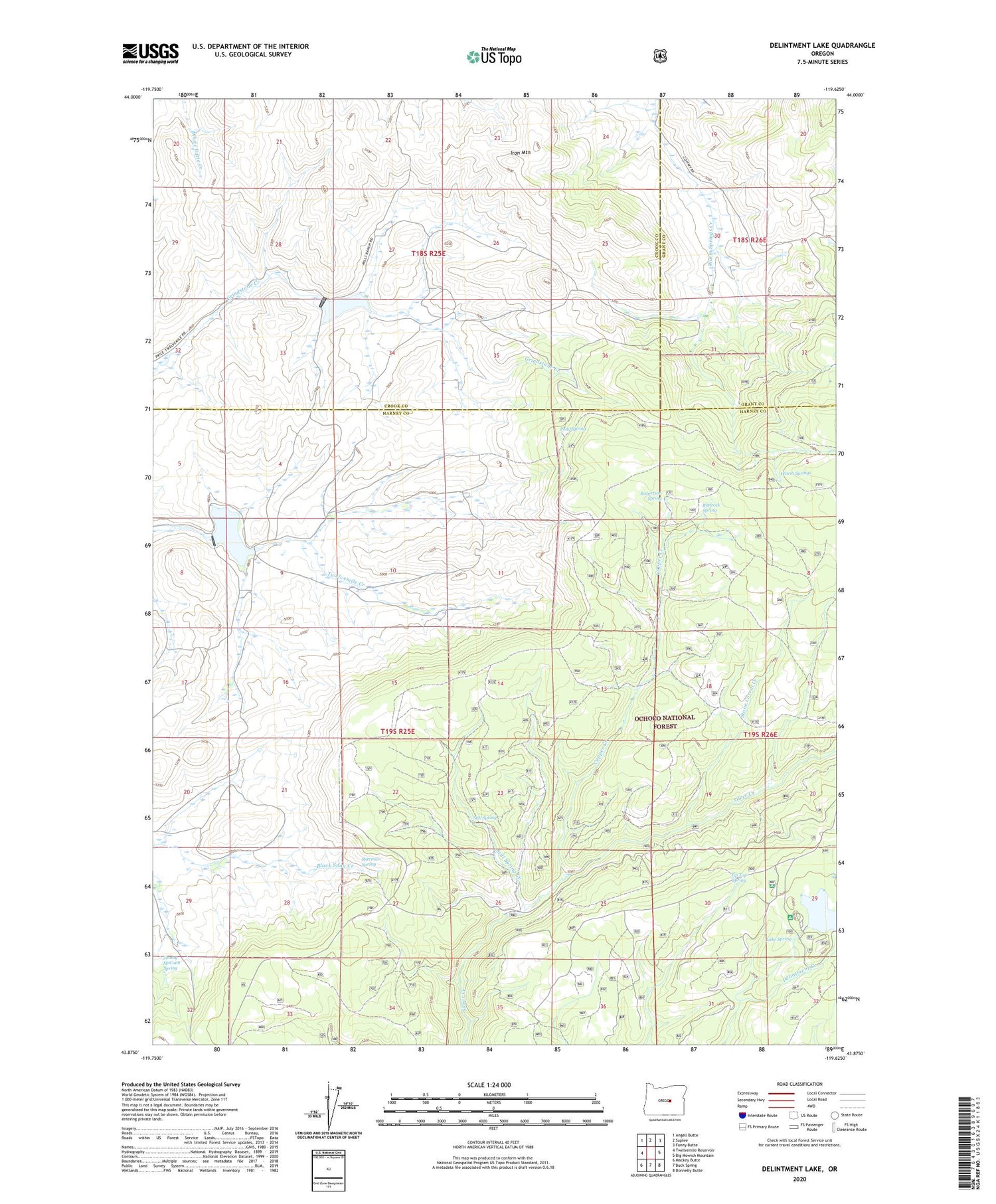
2020 topographic map quadrangle Delintment Lake in the state of Oregon. Scale: 1:24000. Based on the newly updated USGS 7.5' US Topo map series, this map is in the following counties: Harney, Crook, Grant. The map contains contour data, water features, and other items you are used to seeing on USGS maps, but also has updated roads and other features. This is the next generation of topographic maps. Printed on high-quality waterproof paper with UV fade-resistant inks.
Quads adjacent to this one:
West: Twelvemile Reservoir
Northwest: Angell Butte
North: Suplee
Northeast: Funny Butte
East: Big Mowich Mountain
Southeast: Donnelly Butte
South: Buck Spring
Southwest: Mackey Butte
Contains the following named places: Colia Post Office, Copper Creek, Delintment Lake, Delintment Lake Boat Ramp, Delintment Lake Dam, Delintment Lake Recreation Site, Grindstone Dam, Grindstone Reservoir, Iron Mountain, Jimmy McCuen Spring, Lake Spring, Mills Upper Ranch, Pond Spring, Rimrock Spring, Robertson Spring, Sherman Ranch, Sherman Spring, Still Spring, Still Spring Creek, Stone Corral Creek, Tip Top Spring, Twelvemile Dam, Upper Sherman Ranch, Warm Springs, Williams Reservoir


