MyTopo
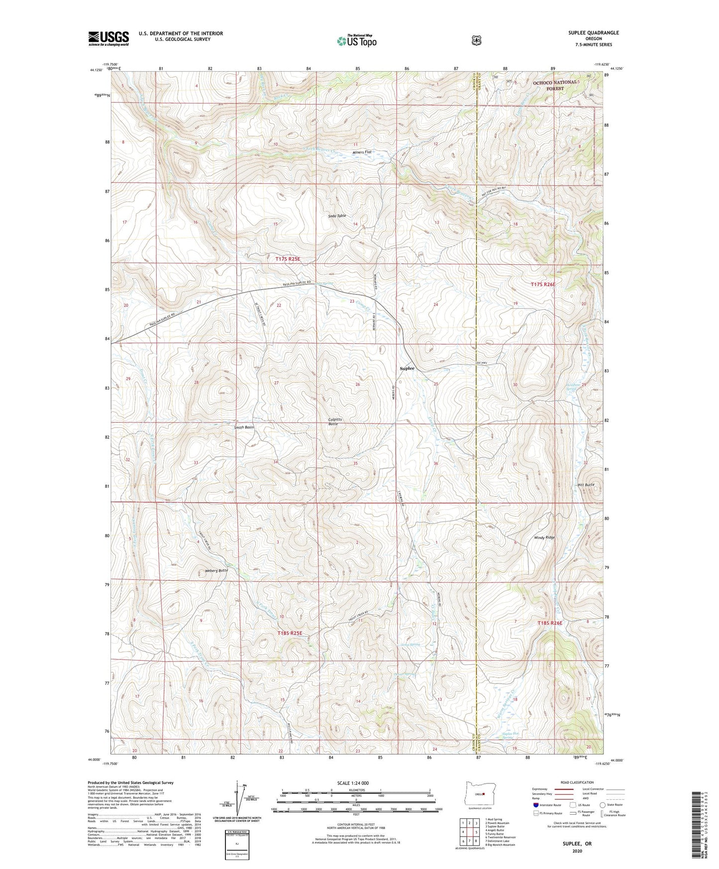
Suplee Oregon US Topo Map
Couldn't load pickup availability
Also explore the Suplee Forest Service Topo of this same quad for updated USFS data
2023 topographic map quadrangle Suplee in the state of Oregon. Scale: 1:24000. Based on the newly updated USGS 7.5' US Topo map series, this map is in the following counties: Crook, Grant. The map contains contour data, water features, and other items you are used to seeing on USGS maps, but also has updated roads and other features. This is the next generation of topographic maps. Printed on high-quality waterproof paper with UV fade-resistant inks.
Quads adjacent to this one:
West: Angell Butte
Northwest: Mud Spring
North: Powell Mountain
Northeast: Suplee Butte
East: Funny Butte
Southeast: Big Mowich Mountain
South: Delintment Lake
Southwest: Twelvemile Reservoir
This map covers the same area as the classic USGS quad with code o44119a6.
Contains the following named places: Bernard Ranch, Camp Creek, Colpitts Butte, Cow Camp, Delore Spring, Dry Rock Creek, H Bernard Ranch, Henshaw Spring, Little Bear Creek, Long Spring, Miners Flat, Negro Creek, North Fork Trout Creek, O'Henry Reservoir, Pitt Butte, Pole Creek, Robertson Ranch, Rock Creek, Smith Basin, Soda Spring, Soda Table, South Fork Trout Creek, Stewart Post Office, Suplee, Suplee Hot Spring, Suplee Post Office, Warm Springs Creek, Weberg Butte, Weberg Ranch, White Butte, Windy Ridge