MyTopo
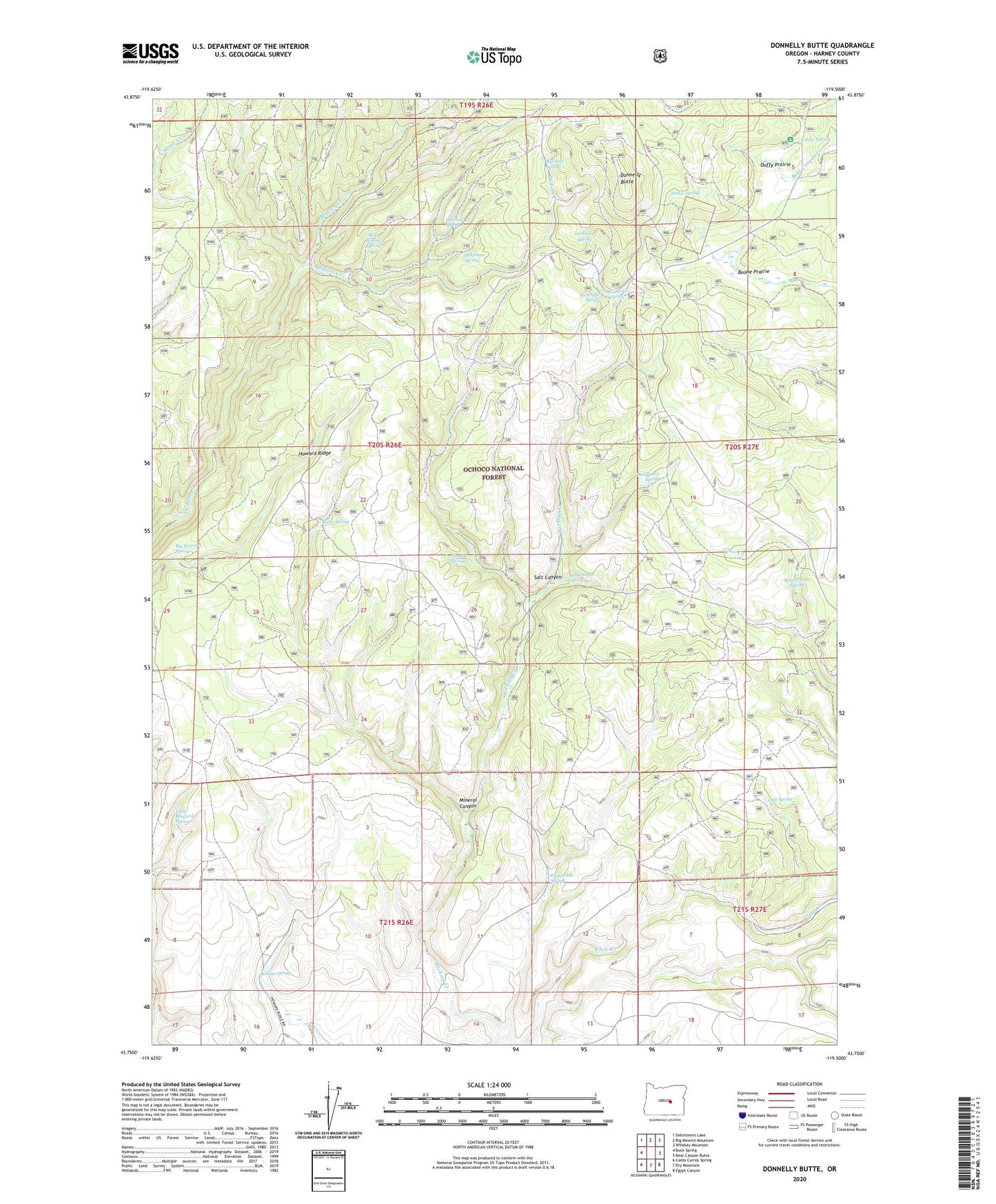
Donnelly Butte Oregon US Topo Map
Couldn't load pickup availability
Also explore the Donnelly Butte Forest Service Topo of this same quad for updated USFS data
2023 topographic map quadrangle Donnelly Butte in the state of Oregon. Scale: 1:24000. Based on the newly updated USGS 7.5' US Topo map series, this map is in the following counties: Harney. The map contains contour data, water features, and other items you are used to seeing on USGS maps, but also has updated roads and other features. This is the next generation of topographic maps. Printed on high-quality waterproof paper with UV fade-resistant inks.
Quads adjacent to this one:
West: Buck Spring
Northwest: Delintment Lake
North: Big Mowich Mountain
Northeast: Whiskey Mountain
East: Bear Canyon Butte
Southeast: Egypt Canyon
South: Dry Mountain
Southwest: Camp Currey Spring
This map covers the same area as the classic USGS quad with code o43119g5.
Contains the following named places: Alder Spring, Bear Wallow Spring, Beaver Dam Spring, Big Howard Spring, Bixby Spring, Boone Prairie, Bullseye Spring, Deadhorse Spring, Donnelly Butte, Donnelly Camp, Duffy Prairie, Dug Spring, Dustbox Spring, Harpham Spring, Howard Ridge, Little Howard Spring, Mineral Canyon, Mutton Creek, Packsaddle Spring, Pinkie Spring, Plumber Spring, Riverside Spring, Roadside Spring, Salt Canyon, Salt Canyon Spring, Wickiup Spring, Willow Spring