MyTopo
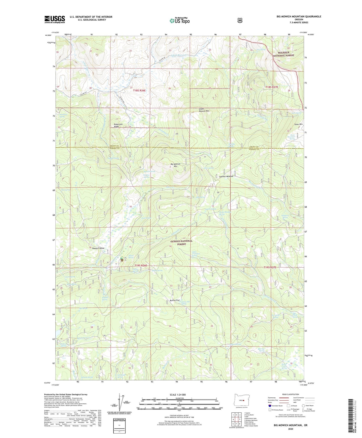
Big Mowich Mountain Oregon US Topo Map
Couldn't load pickup availability
Also explore the Big Mowich Mountain Forest Service Topo of this same quad for updated USFS data
2023 topographic map quadrangle Big Mowich Mountain in the state of Oregon. Scale: 1:24000. Based on the newly updated USGS 7.5' US Topo map series, this map is in the following counties: Harney, Grant. The map contains contour data, water features, and other items you are used to seeing on USGS maps, but also has updated roads and other features. This is the next generation of topographic maps. Printed on high-quality waterproof paper with UV fade-resistant inks.
Quads adjacent to this one:
West: Delintment Lake
Northwest: Suplee
North: Funny Butte
Northeast: Izee
East: Whiskey Mountain
Southeast: Bear Canyon Butte
South: Donnelly Butte
Southwest: Buck Spring
This map covers the same area as the classic USGS quad with code o43119h5.
Contains the following named places: Adams Spring, Allen Spring, Allison Creek, Allison Ranch, Allison Ranger Station, Allison Spring, Beaver Reservoir, Big Mowich Mountain, Blue Jay Spring, Boundary Spring, Button Flat, Button Flat Spring, Clear Creek, Culvert Spring, DK Spring, Dobson Creek, Dobson Spring, Fawn Spring, Fine Spring, Fir Tree Spring, Freeman Creek, Harris Ranch, Helens Spring, Howard Valley, J M Ranch, Jessie Spring, Lehman Meadow, Little Mowich Mountain, Moco Spring, Mowich Spring, Mud Spring, Mutton Camp, Pendleton Spring, Pole Camp Spring, Porcupine Spring, Robertson Ranch, Robertson Ridge, Round Meadow Spring, Silver Spring, Snow Mountain Spring, Snow Spring, Sourdough Spring, Stinking Spring, Swain Prairie Spring, Tamarack Creek, Timothy Spring, Upper Crowsfoot Spring, Weburg Spring, Whistle Creek, Whistle Spring, Willow Spring