MyTopo
Devils Heel Oregon US Topo Map
Couldn't load pickup availability
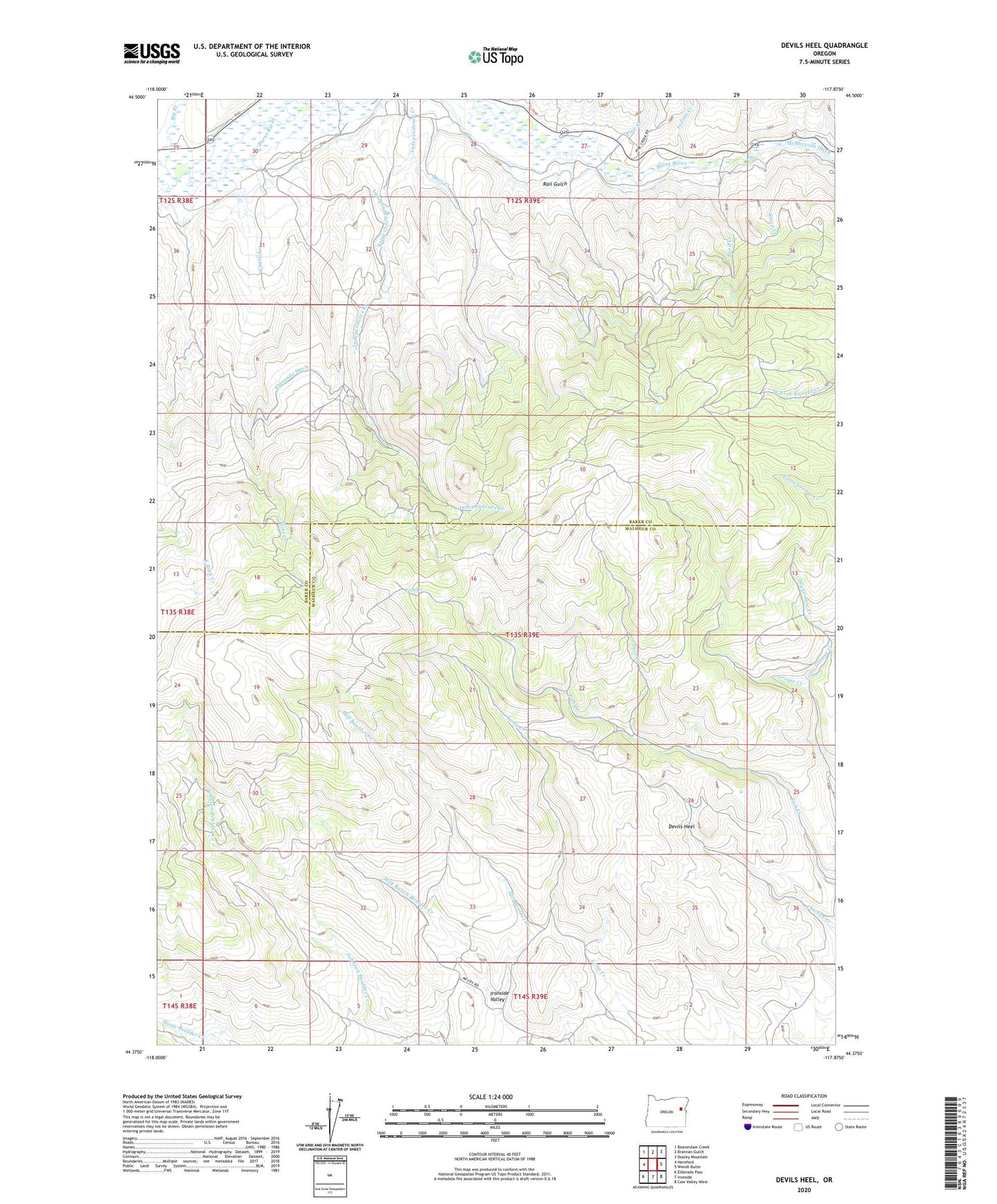
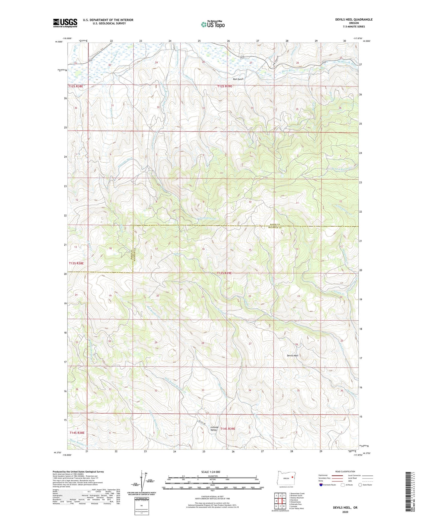
2020 topographic map quadrangle Devils Heel in the state of Oregon. Scale: 1:24000. Based on the newly updated USGS 7.5' US Topo map series, this map is in the following counties: Baker, Malheur. The map contains contour data, water features, and other items you are used to seeing on USGS maps, but also has updated roads and other features. This is the next generation of topographic maps. Printed on high-quality waterproof paper with UV fade-resistant inks.
Quads adjacent to this one:
West: Hereford
Northwest: Beaverdam Creek
North: Brannan Gulch
Northeast: Dooley Mountain
East: Wendt Butte
Southeast: Cow Valley West
South: Ironside
Southwest: Eldorado Pass
Contains the following named places: Big Creek, Burnt River Valley, Deer Creek, Devils Heel, Flint Creek, Independence Creek, Independence Creek Ditch, Indian Creek, Little Grouse Creek, Milk Ranch Boulder Creek, Outhouse Creek, Pine Creek, Rail Gulch, Reed Creek, Reeds Ditch, Steep Creek