MyTopo
Ironside Oregon US Topo Map
Couldn't load pickup availability
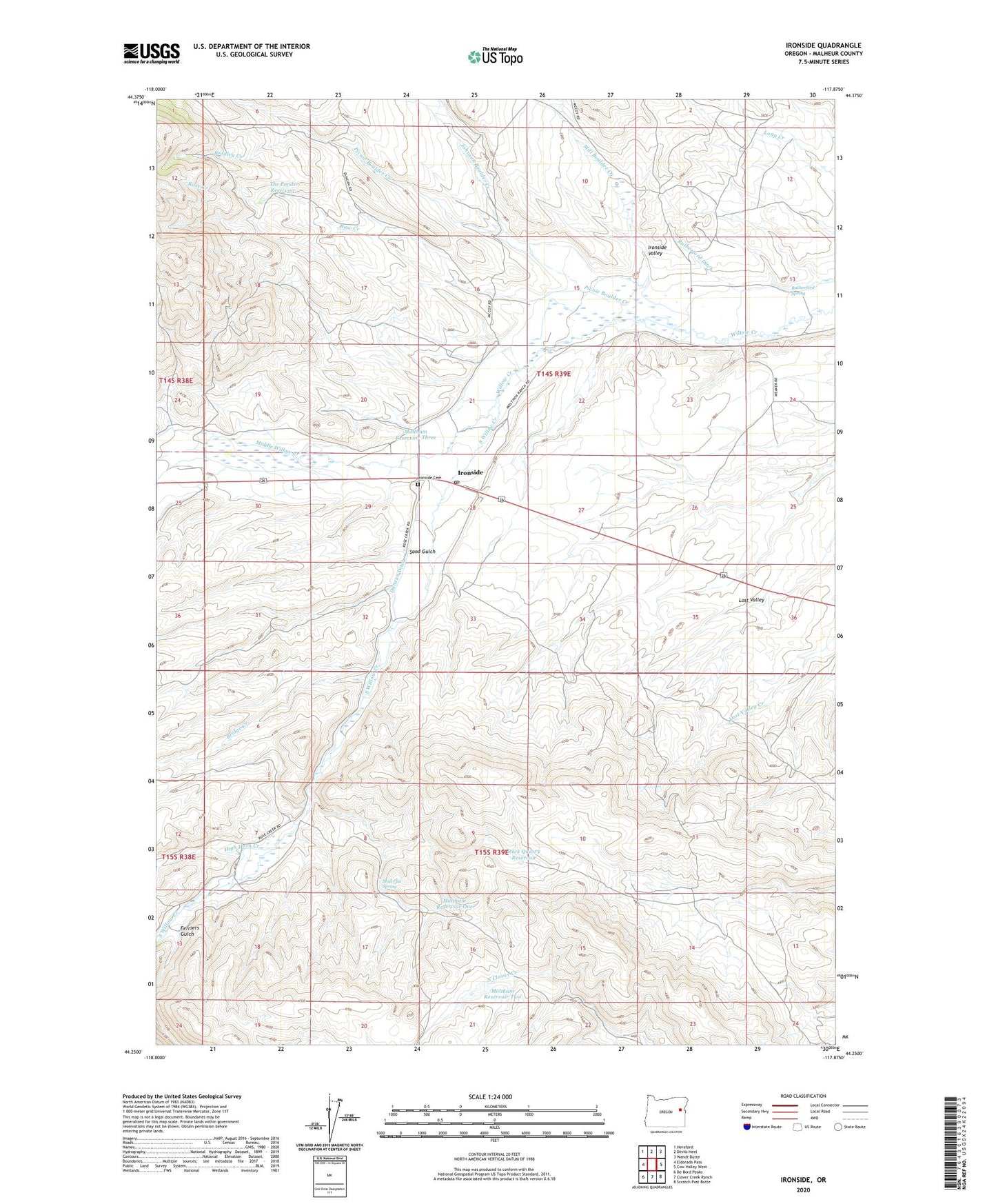
2023 topographic map quadrangle Ironside in the state of Oregon. Scale: 1:24000. Based on the newly updated USGS 7.5' US Topo map series, this map is in the following counties: Malheur. The map contains contour data, water features, and other items you are used to seeing on USGS maps, but also has updated roads and other features. This is the next generation of topographic maps. Printed on high-quality waterproof paper with UV fade-resistant inks.
Quads adjacent to this one:
West: Eldorado Pass
Northwest: Hereford
North: Devils Heel
Northeast: Wendt Butte
East: Cow Valley West
Southeast: Scratch Post Butte
South: Clover Creek Ranch
Southwest: De Bord Peaks
This map covers the same area as the classic USGS quad with code o44117c8.
Contains the following named places: Bradley Creek, Bridge Creek, Camp Colfax, Dry Creek, Duncan Ditch, Ferriers Gulch, High Horn Creek, Ironside, Ironside Cemetery, Ironside Post Office, Ironside School, Ironside Valley, Johnson Boulder Creek, Middle Willow Creek, Mill Boulder Creek, Moltham Reservoir Four, Moltham Reservoir One, Moltham Reservoir Three, Moltham Reservoir Two, Mud Flat Spring, Picnic Boulder Creek, Rock Quarry Reservoir, Rose Creek, Rutherford Ditch, Rutherford Spring, Sand Gulch, South Willow Creek, The Ponds Reservoir, Young Ditch, ZIP Code: 97908