MyTopo
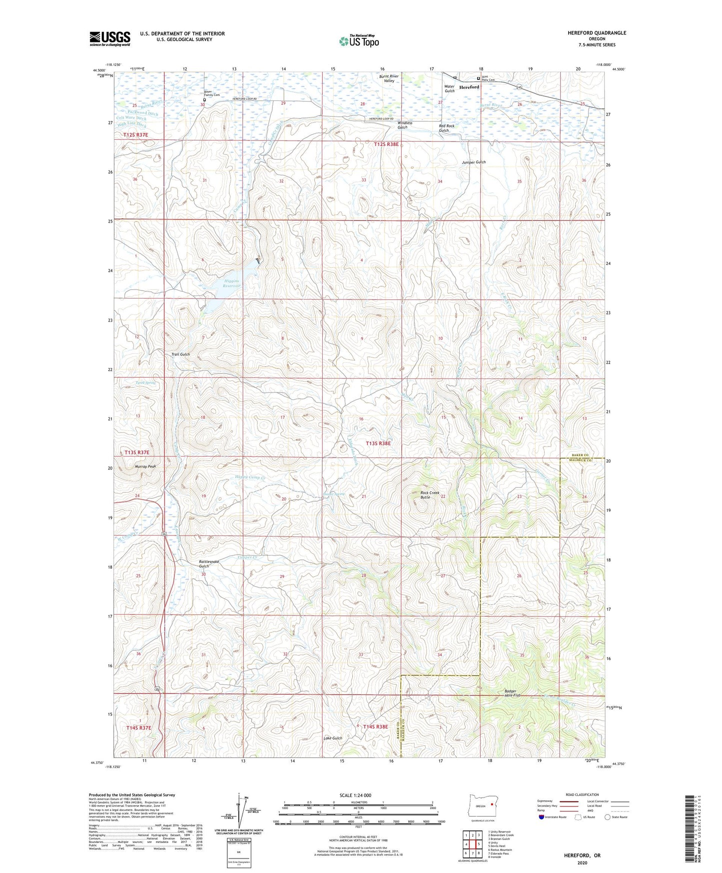
Hereford Oregon US Topo Map
Couldn't load pickup availability
Also explore the Hereford Forest Service Topo of this same quad for updated USFS data
2023 topographic map quadrangle Hereford in the state of Oregon. Scale: 1:24000. Based on the newly updated USGS 7.5' US Topo map series, this map is in the following counties: Baker, Malheur. The map contains contour data, water features, and other items you are used to seeing on USGS maps, but also has updated roads and other features. This is the next generation of topographic maps. Printed on high-quality waterproof paper with UV fade-resistant inks.
Quads adjacent to this one:
West: Unity
Northwest: Unity Reservoir
North: Beaverdam Creek
Northeast: Brannan Gulch
East: Devils Heel
Southeast: Ironside
South: Eldorado Pass
Southwest: Rastus Mountain
This map covers the same area as the classic USGS quad with code o44118d1.
Contains the following named places: Aunt Polly Cemetery, Badger Hole Flat, Boyer Family Cemetery, Camp Creek Ditch, Cook Ditch, Copper Creek, East Camp Creek, East Rock Creek, Garner Creek, Hamer Spring, Happy Camp Creek, Hereford, Hereford Post Office, Higgins Dam, Higgins Reservoir, Juniper Gulch, Mud Creek, Murray Peak, Packwood Ditch, Rattlesnake Gulch, Red Rock Gulch, Rock Creek, Rock Creek Butte, Trail Gulch, Tyrell Spring, Water Gulch, West Camp Creek, Windless Gulch