MyTopo
Diamond Peak Oregon US Topo Map
Couldn't load pickup availability
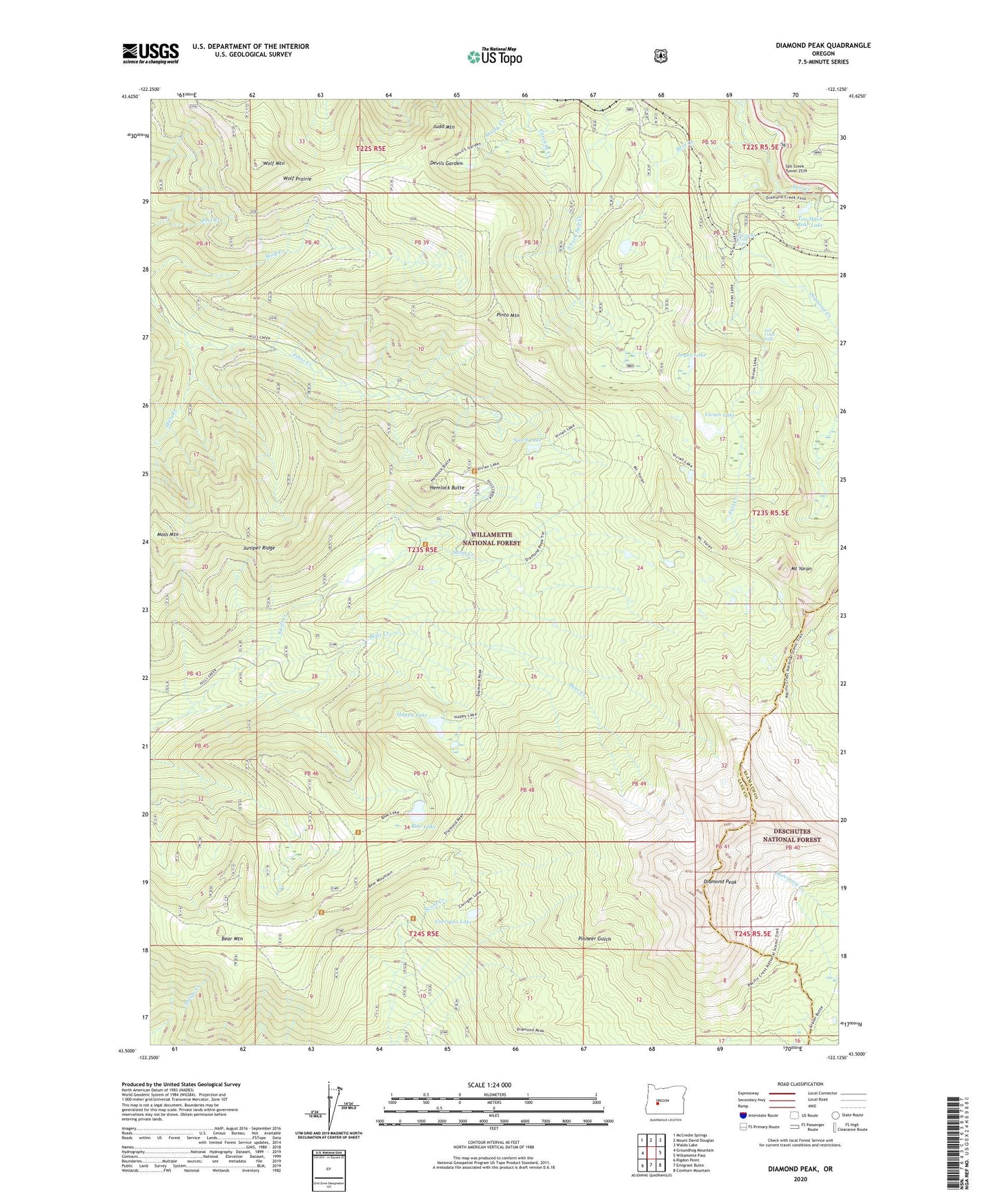
2020 topographic map quadrangle Diamond Peak in the state of Oregon. Scale: 1:24000. Based on the newly updated USGS 7.5' US Topo map series, this map is in the following counties: Lane, Klamath. The map contains contour data, water features, and other items you are used to seeing on USGS maps, but also has updated roads and other features. This is the next generation of topographic maps. Printed on high-quality waterproof paper with UV fade-resistant inks.
Quads adjacent to this one:
West: Groundhog Mountain
Northwest: McCredie Springs
North: Mount David Douglas
Northeast: Waldo Lake
East: Willamette Pass
Southeast: Cowhorn Mountain
South: Emigrant Butte
Southwest: Rigdon Point
Contains the following named places: Bear Creek, Bear Mountain, Bect Creek, Binghams Shelter, Blue Lake, Corrigan Lake, Devils Garden, Diamond Camp, Diamond Creek, Diamond Creek Falls, Diamond Peak, Diamond Peak Trail, Fall Creek, Fall Creek Falls, Happy Lake, Hemlock Butte, Hills Creek Trail, Judd Mountain, Juniper Ridge, Lopez Lake, Moss Mountain, Mount Yoran, Notch Lake, Pinto Creek, Pinto Mountain, Pinto Mountain Way, Salt Creek Falls Recreation Site, Salt Creek Tunnel 2539, Scout Creek, Too Much Bear Lake, Vivian Lake, Wolf Mountain, Wolf Mountain Recreation Site, Wolf Mountain Trail, Wolf Prairie