MyTopo
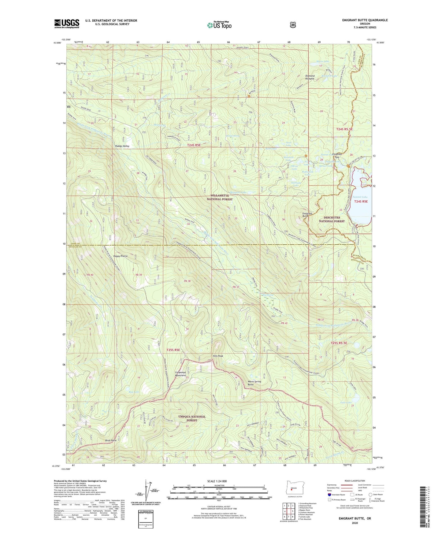
Emigrant Butte Oregon US Topo Map
Couldn't load pickup availability
Also explore the Emigrant Butte Forest Service Topo of this same quad for updated USFS data
2023 topographic map quadrangle Emigrant Butte in the state of Oregon. Scale: 1:24000. Based on the newly updated USGS 7.5' US Topo map series, this map is in the following counties: Lane, Douglas, Klamath. The map contains contour data, water features, and other items you are used to seeing on USGS maps, but also has updated roads and other features. This is the next generation of topographic maps. Printed on high-quality waterproof paper with UV fade-resistant inks.
Quads adjacent to this one:
West: Rigdon Point
Northwest: Groundhog Mountain
North: Diamond Peak
Northeast: Willamette Pass
East: Cowhorn Mountain
Southeast: Tolo Mountain
South: Lemolo Lake
Southwest: Potter Mountain
This map covers the same area as the classic USGS quad with code o43122d2.
Contains the following named places: Alameda Lake, Alpine Lake, Beaver Creek, Beaver Marsh, Big Swamp, Birds Point, Bug Lake, Diamond Rockpile, Emigrant Butte, Emigrant Creek, Emigrant Forest Camp, Emigrant Pass, Fir Lake, Happy Prairie, Happy Prairie Way, Hemlock Lake, Hills Peak, June Lake, Marie Lake, McGowan Mountain Way, Mosquito Lake, Neet Lake, Paddys Valley, Pioneer Way, Reflection Lake, Rockpile Lake, Ruth Lake, Sawtooth Way, Spruce Lake, Summit Lake Boat Launch, Summit Lake Recreation Site, Sunrise Lake, Sunset Lake, Swamp Way, Timpanogas Way, Warm Spring Butte