MyTopo
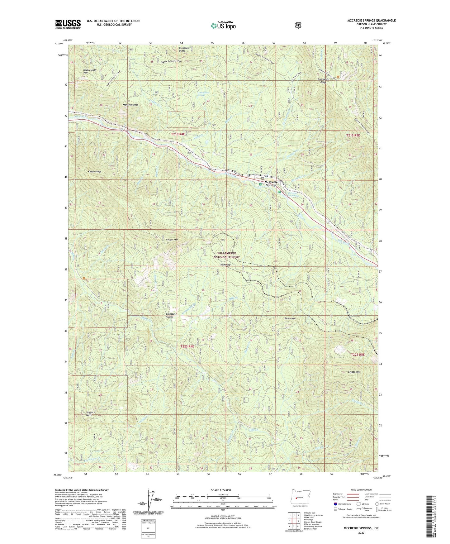
McCredie Springs Oregon US Topo Map
Couldn't load pickup availability
Also explore the McCredie Springs Forest Service Topo of this same quad for updated USFS data
2023 topographic map quadrangle McCredie Springs in the state of Oregon. Scale: 1:24000. Based on the newly updated USGS 7.5' US Topo map series, this map is in the following counties: Lane. The map contains contour data, water features, and other items you are used to seeing on USGS maps, but also has updated roads and other features. This is the next generation of topographic maps. Printed on high-quality waterproof paper with UV fade-resistant inks.
Quads adjacent to this one:
West: Oakridge
Northwest: Westfir East
North: Huckleberry Mountain
Northeast: Blair Lake
East: Mount David Douglas
Southeast: Diamond Peak
South: Groundhog Mountain
Southwest: Warner Mountain
This map covers the same area as the classic USGS quad with code o43122f3.
Contains the following named places: Basin Creek, Beach Mountain, Blue Pool Recreation Site, Bunchgrass Trail, Burro Creek, Cottonwood Spring, Cougar Mountain, Coyote Mountain, Crabapple Creek, Crabapple Prairie, Fields, Fin Roberts Creek, Frazier, Gate Creek, Gate Creek Forest Camp, Gobel Creek, Gobel Creek Trail, Heckletooth Mountain, Juniper Creek, Kitson Hot Springs, Kitson Ridge, Kitson Ridge Trail, Kwiskwis Butte, Landes Creek, Little Bunchgrass Lookout, McCredie Creek, McCredie Hot Springs, McCredie Springs, McCredie Springs Post Office, Mike Creek, Monteith Rock, North Fork Groundhog Creek, Oakridge Division, Owl Cabin Way, Pepper Creek, Sage Creek, Shady Creek, Shady Gap, Skipper Creek, Slapjack Butte, South Fork Groundhog Creek, Squaw Butte Trail, Sugar Creek, TNT Creek, Tufti Creek, Warfield Creek, Warner Creek, Wicopee