MyTopo
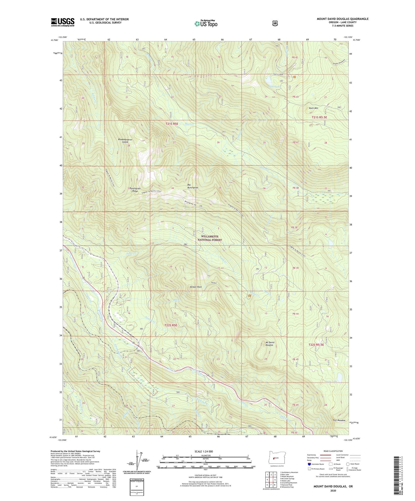
Mount David Douglas Oregon US Topo Map
Couldn't load pickup availability
Also explore the Mount David Douglas Forest Service Topo of this same quad for updated USFS data
2023 topographic map quadrangle Mount David Douglas in the state of Oregon. Scale: 1:24000. Based on the newly updated USGS 7.5' US Topo map series, this map is in the following counties: Lane. The map contains contour data, water features, and other items you are used to seeing on USGS maps, but also has updated roads and other features. This is the next generation of topographic maps. Printed on high-quality waterproof paper with UV fade-resistant inks.
Quads adjacent to this one:
West: McCredie Springs
Northwest: Huckleberry Mountain
North: Blair Lake
Northeast: Waldo Mountain
East: Waldo Lake
Southeast: Willamette Pass
South: Diamond Peak
Southwest: Groundhog Mountain
This map covers the same area as the classic USGS quad with code o43122f2.
Contains the following named places: Beamer Ranch, Big Bunchgrass, Blink Creek, Cascade Creek, Cedar Creek, Cornpatch Prairie, Coyote Creek, Cruzatte, Cruzatte Post Office, Cupit Mary Trail, Doe Creek, Eagle Camp, Eagle Creek, Fuji Meadow, Heather, Helen Creek Way, Hells Half Acre, Koch Mountain Trail, Last Creek, Louise Creek, Lucas Lake, Mount David Douglas, Noisy Creek, Petite Creek, Rhododendron Island, Salt Creek Safety Rest Area, Shady Creek, South Fork Salt Creek, Spirit Lake, Swamp Creek, Twin Creek, Verdun Rock, Verdun Way