
MyTopo
Dixie Meadows Oregon US Topo Map
Couldn't load pickup availability
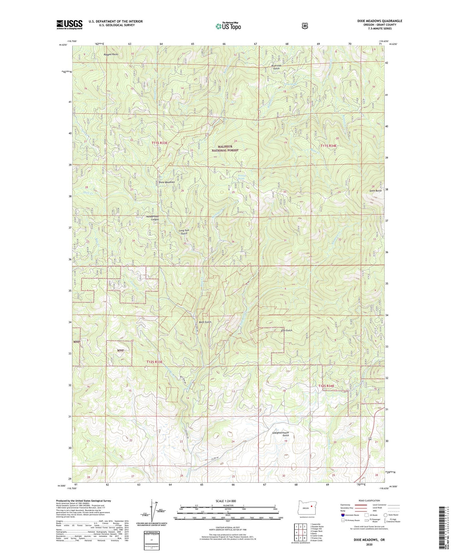
2020 topographic map quadrangle Dixie Meadows in the state of Oregon. Scale: 1:24000. Based on the newly updated USGS 7.5' US Topo map series, this map is in the following counties: Grant. The map contains contour data, water features, and other items you are used to seeing on USGS maps, but also has updated roads and other features. This is the next generation of topographic maps. Printed on high-quality waterproof paper with UV fade-resistant inks.
Quads adjacent to this one:
West: Cougar Rock
Northwest: Susanville
North: Boulder Butte
Northeast: Vinegar Hill
East: Bates
Southeast: Isham Creek
South: Prairie City
Southwest: Castle Creek
Contains the following named places: Bennett Creek, Boulder Group Mine, Buck Gulch, Bull Run Creek, Camp Spring, Comer, Comer Creek, Comer Post Office, Copperopolis Mine, Cougar Ridge, Cougar Ridge Mine, Dixie Butte, Dixie Butte Fire Lookout Tower, Dixie Meadows, Dixie Meadows Mine, Ella Gulch, Honeymoon Canyon, Keystone Mine, Lick Creek Trail, Long Tom Gulch, Ragged Rocks Trail, Shatt Mine, Smuggler Mine, Standard Creek, Standard Mine, Sulphur Creek, Wickiup Creek, Wickiup Spring


