MyTopo
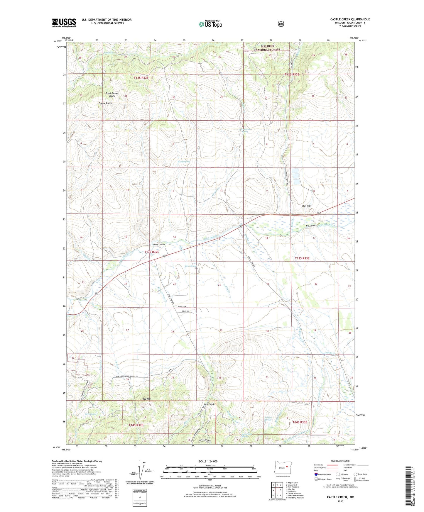
Castle Creek Oregon US Topo Map
Couldn't load pickup availability
Also explore the Castle Creek Forest Service Topo of this same quad for updated USFS data
2024 topographic map quadrangle Castle Creek in the state of Oregon. Scale: 1:24000. Based on the newly updated USGS 7.5' US Topo map series, this map is in the following counties: Grant. The map contains contour data, water features, and other items you are used to seeing on USGS maps, but also has updated roads and other features. This is the next generation of topographic maps. Printed on high-quality waterproof paper with UV fade-resistant inks.
Quads adjacent to this one:
West: John Day
Northwest: Magone Lake
North: Cougar Rock
Northeast: Dixie Meadows
East: Prairie City
Southeast: Strawberry Mountain
South: Pine Creek Mountain
Southwest: Canyon Mountain
This map covers the same area as the classic USGS quad with code o44118d7.
Contains the following named places: Bear Creek, Bear Gulch, Big Gulch, Birch Spring, Butch Foster Saddle, Castle Creek, Clark Ranch, Cottonwood Spring, Dead Horse Spring, Dean Creek, Deep Gulch, Dissel Creek, Fisk Creek, Grub Creek, Gwyn Creek, H Coombs Ranch, H Ricco Ranch, Hall Hill, Hardy Spring, Holiday Ranch, Holliday Ranch, Howard Ranch, Indian Creek, Indian Creek School, John Day River Dam, Johnson Ranch, Johnson Springs, Jones Spring, Kuhl Ranch, Little Indian Creek, McKinney Creek, Oliver Ranch, Oliver Rock, Pine Creek, Prairie City Wastewater Treatment Lagoons, Prairie Diggings, Red Hill, West Fork Little Indian Creek, West Fork Pine Creek