MyTopo
Vinegar Hill Oregon US Topo Map
Couldn't load pickup availability
Also explore the Vinegar Hill Forest Service Topo of this same quad for updated USFS data
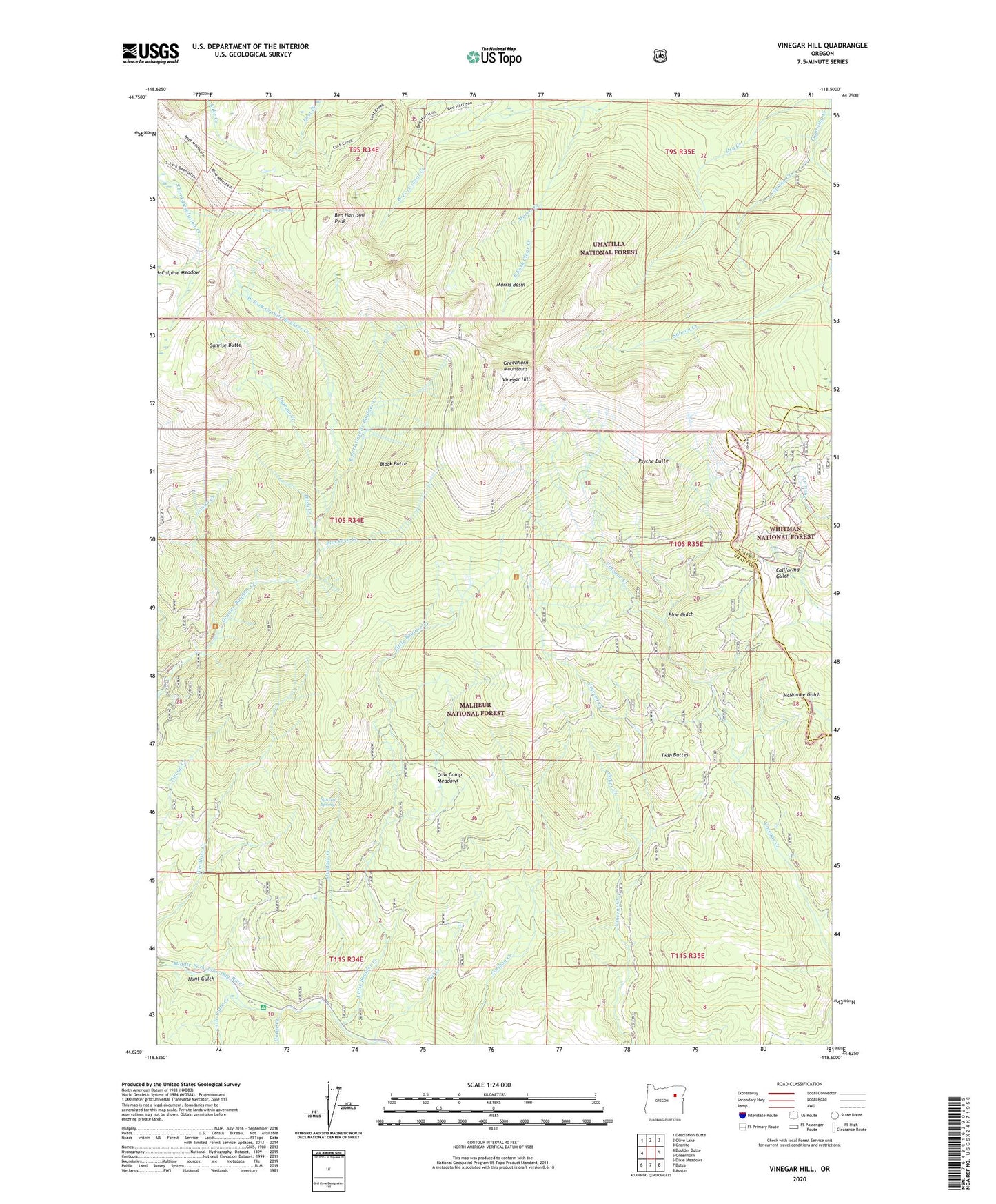
2024 topographic map quadrangle Vinegar Hill in the state of Oregon. Scale: 1:24000. Based on the newly updated USGS 7.5' US Topo map series, this map is in the following counties: Grant, Baker. The map contains contour data, water features, and other items you are used to seeing on USGS maps, but also has updated roads and other features. This is the next generation of topographic maps. Printed on high-quality waterproof paper with UV fade-resistant inks.
Quads adjacent to this one:
West: Boulder Butte
Northwest: Desolation Butte
North: Olive Lake
Northeast: Granite
East: Greenhorn
Southeast: Austin
South: Bates
Southwest: Dixie Meadows
This map covers the same area as the classic USGS quad with code o44118f5.
Contains the following named places: Banner Mine, Ben Harrison Mine, Ben Harrison Peak, Bimetallic Mine, Black Butte, Blackeye Creek, Blue Gulch, Butler Mine, Camp Simms, Cow Camp Meadows, Ditch Creek, Duprat Spring, East Fork Clear Creek, East Fork Granite Boulder Creek, Flat Creek, Fryes Mine, Gorge Creek, Greenhorn Mountains, Hunt Gulch, Ingram Creek, Lemon Cabin, Lemon Creek, Little Boulder Creek, Little Butte Creek, Little Doe Mine, Middle Fork Recreation Site, Morning Creek, Morning Mine, Morris Basin, Morris Creek, Morris Mine, Murdock Creek, Poker Creek, Porky Creek, Portland Mine, Psyche Butte, Roberts Mine, Salmon Creek, Spring Creek, Sunrise Butte, Sunrise Spring, Tempest Mine, Tiger Mine, Twin Buttes, Vinegar Hill, West Fork Clear Creek, West Fork Granite Boulder Creek, ZIP Code: 97817