MyTopo
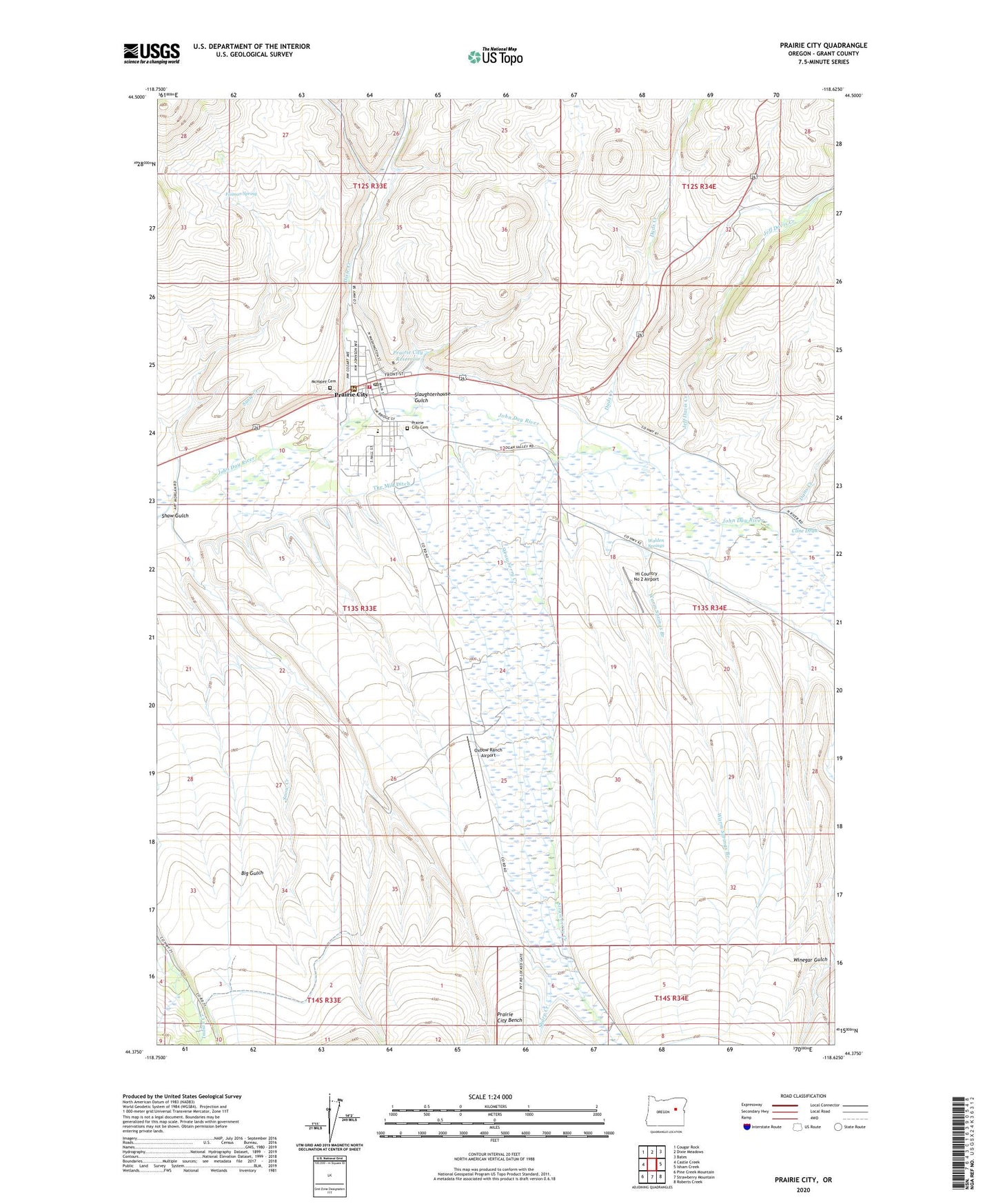
Prairie City Oregon US Topo Map
Couldn't load pickup availability
Also explore the Prairie City Forest Service Topo of this same quad for updated USFS data
2023 topographic map quadrangle Prairie City in the state of Oregon. Scale: 1:24000. Based on the newly updated USGS 7.5' US Topo map series, this map is in the following counties: Grant. The map contains contour data, water features, and other items you are used to seeing on USGS maps, but also has updated roads and other features. This is the next generation of topographic maps. Printed on high-quality waterproof paper with UV fade-resistant inks.
Quads adjacent to this one:
West: Castle Creek
Northwest: Cougar Rock
North: Dixie Meadows
Northeast: Bates
East: Isham Creek
Southeast: Roberts Creek
South: Strawberry Mountain
Southwest: Pine Creek Mountain
This map covers the same area as the classic USGS quad with code o44118d6.
Contains the following named places: A Coombs Ranch, B Standbro Ranch, Camp Logan, Carter Ranch, City of Prairie City, Cline Draw, Dads Creek, Dans Creek, Depot Park Recreation Site, DeWitt Museum, Dixie Creek, Faiman Spring, H Coombs Ranch, Hi Country No 2 Airport, I Standbro Ranch, Jeff Davis Creek, McHaley Cemetery, Oxbow Ranch, Oxbow Ranch Airport, Prairie City, Prairie City Bench, Prairie City Cemetery, Prairie City City Hall, Prairie City Depot, Prairie City Fire Department, Prairie City Forest Service Depot, Prairie City Police Department, Prairie City Post Office, Prairie City Public Works Department Office, Prairie City Ranger Station, Prairie City Reservoir, Prairie City School, Prairie Wood Products Cogen 1 Biomass Facility, Ray Ranch, Sharp Creek, Shaw Gulch, Slaughterhouse Gulch, Snow Creek, Strawberry Creek, Susie Creek, The Mill Ditch, Velvin Ranch, Walden Springs, Warm Springs Branch, Winegar Ranch, ZIP Code: 97869