MyTopo
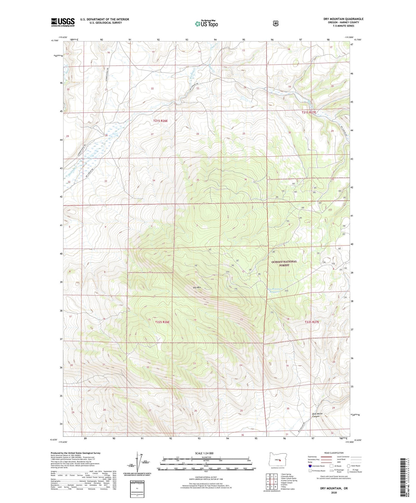
Dry Mountain Oregon US Topo Map
Couldn't load pickup availability
Also explore the Dry Mountain Forest Service Topo of this same quad for updated USFS data
2023 topographic map quadrangle Dry Mountain in the state of Oregon. Scale: 1:24000. Based on the newly updated USGS 7.5' US Topo map series, this map is in the following counties: Harney. The map contains contour data, water features, and other items you are used to seeing on USGS maps, but also has updated roads and other features. This is the next generation of topographic maps. Printed on high-quality waterproof paper with UV fade-resistant inks.
Quads adjacent to this one:
West: Camp Currey Spring
Northwest: Buck Spring
North: Donnelly Butte
Northeast: Bear Canyon Butte
East: Egypt Canyon
Southeast: Oakerman Lakes
South: Riley
Southwest: Suntex
This map covers the same area as the classic USGS quad with code o43119f5.
Contains the following named places: Claw Creek, Dry Mountain, Dry Mountain Reservoir, Egypt Creek, Mitch Canyon