MyTopo
Duncan Oregon US Topo Map
Couldn't load pickup availability
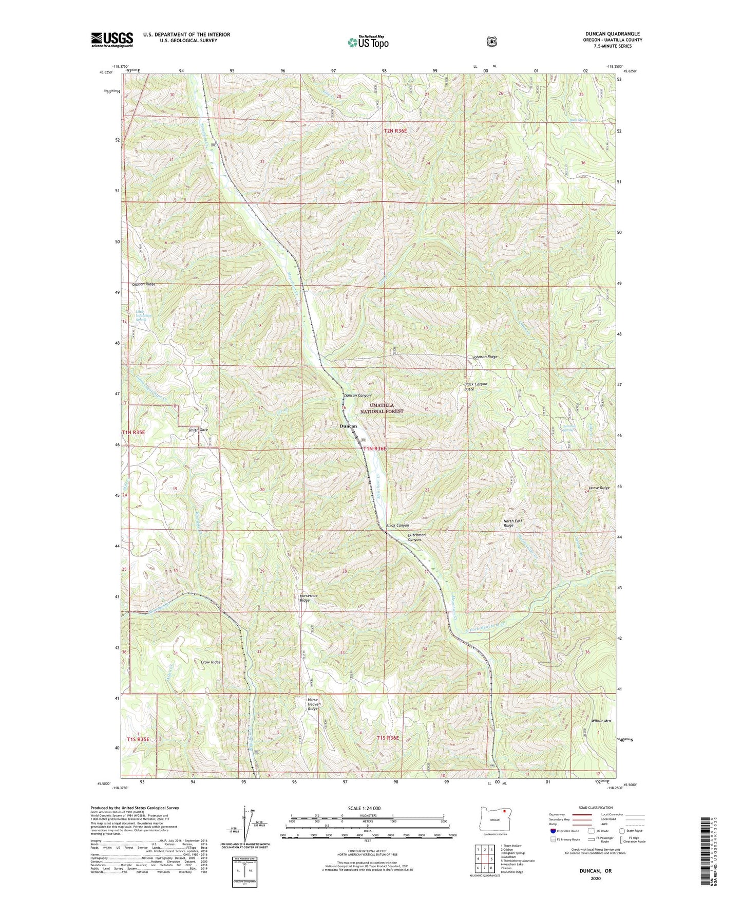
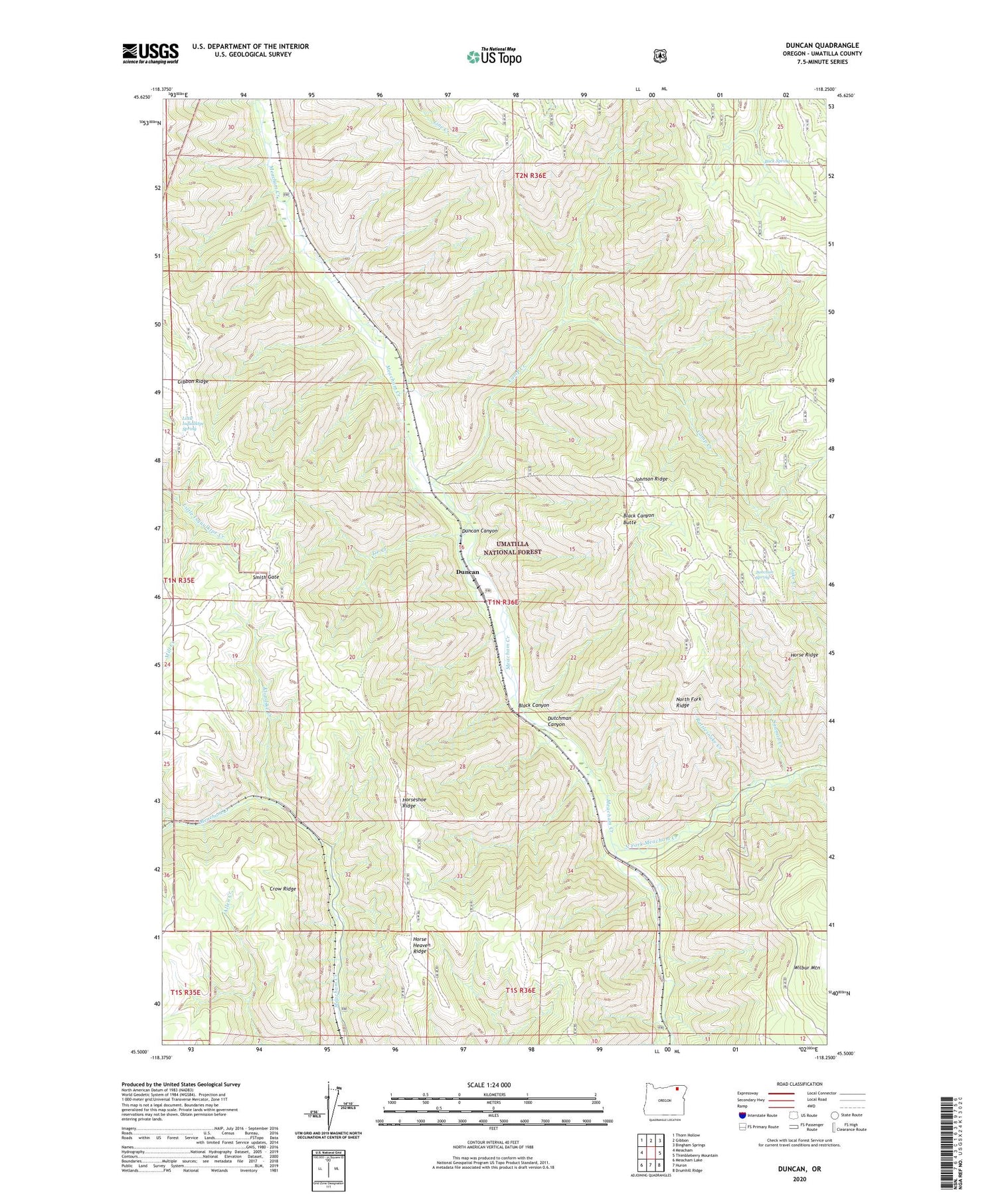
2020 topographic map quadrangle Duncan in the state of Oregon. Scale: 1:24000. Based on the newly updated USGS 7.5' US Topo map series, this map is in the following counties: Umatilla. The map contains contour data, water features, and other items you are used to seeing on USGS maps, but also has updated roads and other features. This is the next generation of topographic maps. Printed on high-quality waterproof paper with UV fade-resistant inks.
Quads adjacent to this one:
West: Meacham
Northwest: Thorn Hollow
North: Gibbon
Northeast: Bingham Springs
East: Thimbleberry Mountain
Southeast: Drumhill Ridge
South: Huron
Southwest: Meacham Lake
Contains the following named places: Black Canyon, Black Canyon Butte, Buck Spring, Camp Creek, Crow Ridge, Duncan, Duncan Canyon, Duncan Guard Station, Duncan Post Office, Dutchman Canyon, Gibbon Ridge, Horse Heaven Ridge, Horse Ridge, Horseshoe Ridge, Johnson Ridge, Junction Spring, Klondike Creek, Little Isquulktpe Spring, North Fork, North Fork Meacham Creek, North Fork Ridge, Porter, Rattlesnake Creek, Sawalish Airstrip, Sawmill Creek, Sloan, Smith Gate, Swart Post Office, Tie Creek, Wilbur