MyTopo
Thorn Hollow Oregon US Topo Map
Couldn't load pickup availability
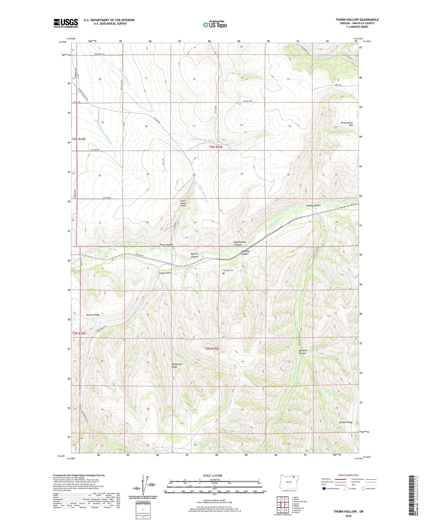
2023 topographic map quadrangle Thorn Hollow in the state of Oregon. Scale: 1:24000. Based on the newly updated USGS 7.5' US Topo map series, this map is in the following counties: Umatilla. The map contains contour data, water features, and other items you are used to seeing on USGS maps, but also has updated roads and other features. This is the next generation of topographic maps. Printed on high-quality waterproof paper with UV fade-resistant inks.
Quads adjacent to this one:
West: Cayuse
Northwest: Adams
North: Athena
Northeast: Weston Mountain
East: Gibbon
Southeast: Duncan
South: Meacham
Southwest: Cabbage Hill
This map covers the same area as the classic USGS quad with code o45118f4.
Contains the following named places: Bachelor Canyon, Buckaroo Creek, East Fork Spring Hollow Creek, Isquulktpe Creek, Rattlesnake Canyon, Red Elk Canyon, Red Elk Cemetery, Saddle Hollow, Shaplish Canyon, Stage Gulch, Thorn Hollow, Thorn Hollow Creek, Thorn Hollow Grade, Thornhollow Post Office, Tumia, ZIP Code: 97810