MyTopo
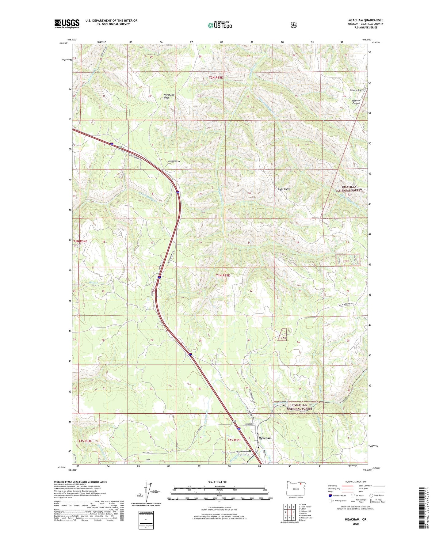
Meacham Oregon US Topo Map
Couldn't load pickup availability
Also explore the Meacham Forest Service Topo of this same quad for updated USFS data
2024 topographic map quadrangle Meacham in the state of Oregon. Scale: 1:24000. Based on the newly updated USGS 7.5' US Topo map series, this map is in the following counties: Umatilla. The map contains contour data, water features, and other items you are used to seeing on USGS maps, but also has updated roads and other features. This is the next generation of topographic maps. Printed on high-quality waterproof paper with UV fade-resistant inks.
Quads adjacent to this one:
West: Cabbage Hill
Northwest: Cayuse
North: Thorn Hollow
Northeast: Gibbon
East: Duncan
Southeast: Huron
South: Meacham Lake
Southwest: Bassey Creek
This map covers the same area as the classic USGS quad with code o45118e4.
Contains the following named places: Beaver Creek, Emigrant Springs State Heritage Area, Isquulktpe Creek Overlook, Light Ridge, Little Isquulktpe Creek, Meacham, Meacham Cemetery, Meacham Census Designated Place, Meacham Post Office, Mill Creek, Sheep Creek, Telephone Ridge, Tod Creek, Twomile Creek, ZIP Code: 97859