MyTopo
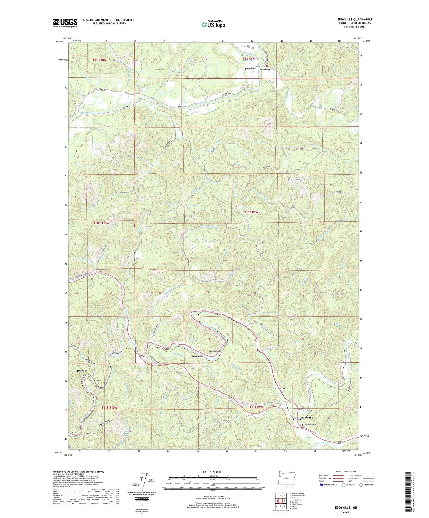
Eddyville Oregon US Topo Map
Couldn't load pickup availability
2020 topographic map quadrangle Eddyville in the state of Oregon. Scale: 1:24000. Based on the newly updated USGS 7.5' US Topo map series, this map is in the following counties: Lincoln. The map contains contour data, water features, and other items you are used to seeing on USGS maps, but also has updated roads and other features. This is the next generation of topographic maps. Printed on high-quality waterproof paper with UV fade-resistant inks.
Quads adjacent to this one:
West: Toledo North
Northwest: Mowrey Landing
North: Euchre Mountain
Northeast: Valsetz
East: Nortons
Southeast: Harlan
South: Elk City
Southwest: Toledo South
Contains the following named places: Adams Creek, Baker Creek, Bales Creek, Bear Creek, Bentilla Creek, Bevens Quarry, Chitwood, Chitwood Cemetery, Chitwood Post Office, Cobb, Cook Creek, Cougar Creek, Crystal Creek, Derrick Lake, Eddy Cemetery, Eddy Creek, Eddyville, Eddyville Cemetery, Eddyville Charter School, Eddyville Post Office, Eddyville School, Elk City Cemetery, Haxel Creek, Hayes Creek, Klamath Creek, Little Carlisle Creek, Little Elk, Little Elk Creek, Logsden, Logsden Post Office, Long Prairie Creek, Long Tom Creek, Mann Creek, Martin Creek, Miami Quarry Company, Mill Creek, Morrison, Native American Church of Siletz, Orton Bridge, Peterson Creek, Pioneer, Pioneer City, Pioneer City Post Office, Pioneer Lumber Company, Pioneer Post Office, Rock Creek, Sam Creek, Sams Creek Boat Launch, Satter Creek, Scott Creek, Siletz Rural Fire Protection District Logsden Substation, Simpson Creek, Sloop Creek, Spring Brook, Thayer Creek, Thornton Creek, Toledo Fire and Rescue Department Station 43, Trapp Creek, Trembley Lake, Trout Creek, Twentythree Creek, Twin Bridges County Park, Twin Bridges Park Boat Ramp, Whitney Creek, WOW Log Pond