MyTopo
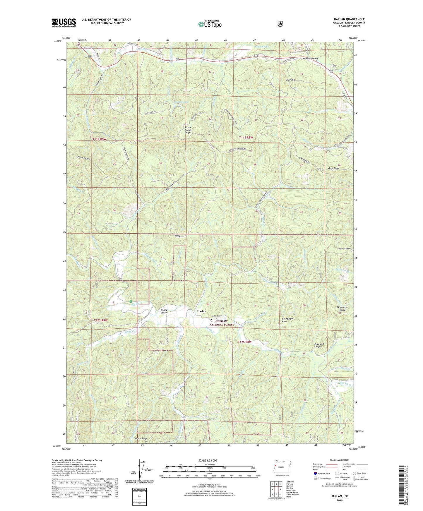
Harlan Oregon US Topo Map
Couldn't load pickup availability
Also explore the Harlan Forest Service Topo of this same quad for updated USFS data
2023 topographic map quadrangle Harlan in the state of Oregon. Scale: 1:24000. Based on the newly updated USGS 7.5' US Topo map series, this map is in the following counties: Lincoln. The map contains contour data, water features, and other items you are used to seeing on USGS maps, but also has updated roads and other features. This is the next generation of topographic maps. Printed on high-quality waterproof paper with UV fade-resistant inks.
Quads adjacent to this one:
West: Elk City
Northwest: Eddyville
North: Nortons
Northeast: Summit
East: Marys Peak
Southeast: Alsea
South: Grass Mountain
Southwest: Hellion Rapids
This map covers the same area as the classic USGS quad with code o44123e6.
Contains the following named places: Adams Creek, Austin Creek, Baker Creek, Baldy, Barber Post Office, Beaver Creek, Beaver Dam Creek, Bevens Creek, Big Elk Campground, Big Elk Guard Station, Big Elk Valley, Bradish Lake, Branch Creek, Chapel of the Valley, Chinquapin Point, Chinquapin Ridge, Cline Creek, Cline Hill, Cline Hill Summit, Cougar Creek, Coyote Creek, Crawford Canyon, Eddyville Division, Ellmaker Creek, Ellmaker State Wayside, Feagles Creek, Goat Ridge, Grant Creek, Harlan, Harlan Cemetery, Harlan Post Office, Johnson Creek, Lake Creek, Leverage Creek, Little Creek, Little Wolf Creek, Miller Creek, Oglesby Creek, Perry Creek, Peterson Creek, Rail Creek, Salmon Creek, Savage Creek, Spout Creek, Strom Boulder Ridge, Sugarbowl Creek, Taylor Ridge, Wakefield Creek, West Fork Feagles Creek, Whiskey Creek, Wolf Creek