MyTopo
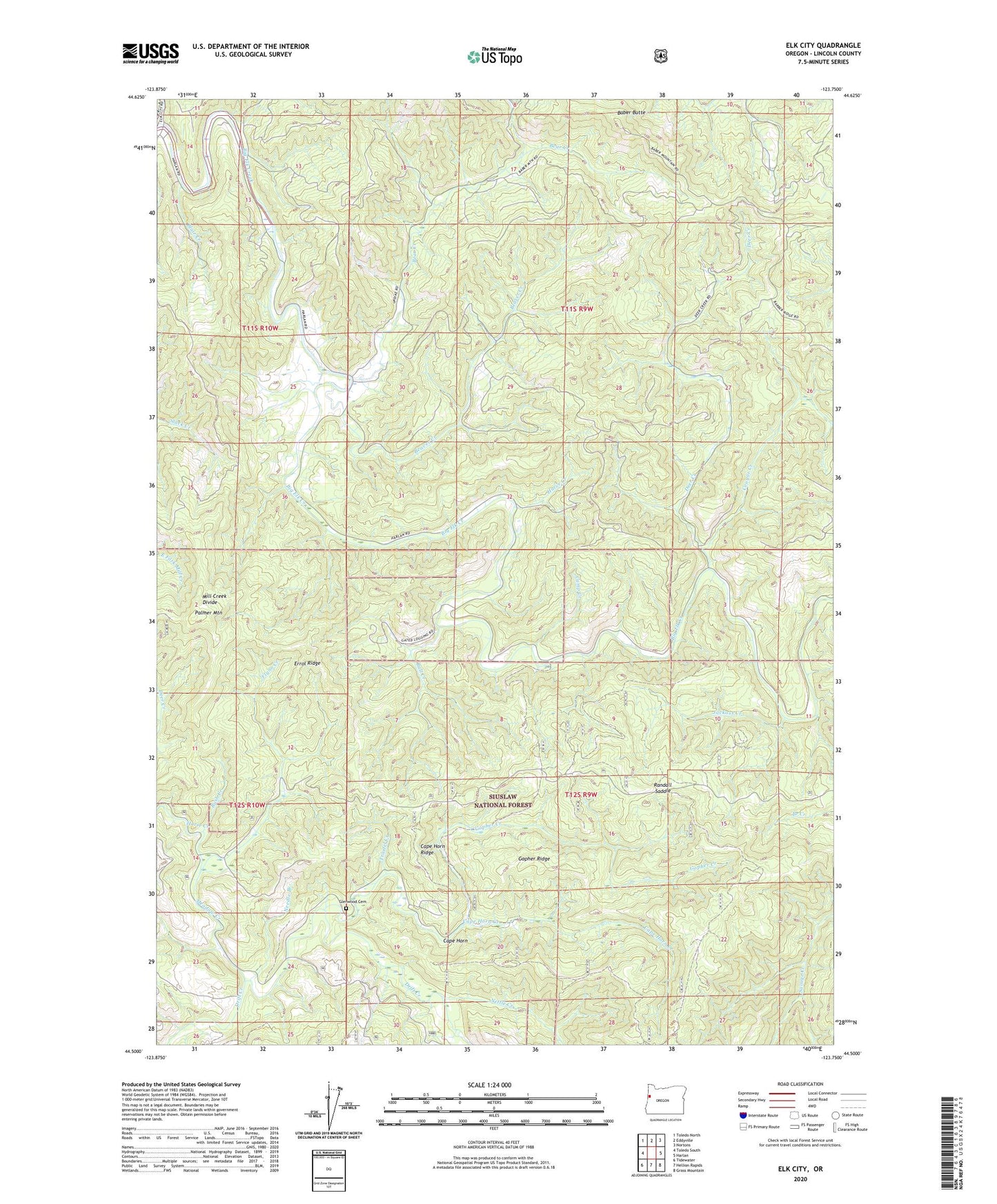
Elk City Oregon US Topo Map
Couldn't load pickup availability
Also explore the Elk City Forest Service Topo of this same quad for updated USFS data
2023 topographic map quadrangle Elk City in the state of Oregon. Scale: 1:24000. Based on the newly updated USGS 7.5' US Topo map series, this map is in the following counties: Lincoln. The map contains contour data, water features, and other items you are used to seeing on USGS maps, but also has updated roads and other features. This is the next generation of topographic maps. Printed on high-quality waterproof paper with UV fade-resistant inks.
Quads adjacent to this one:
West: Toledo South
Northwest: Toledo North
North: Eddyville
Northeast: Nortons
East: Harlan
Southeast: Grass Mountain
South: Hellion Rapids
Southwest: Tidewater
This map covers the same area as the classic USGS quad with code o44123e7.
Contains the following named places: Baber Butte, Baber Lookout, Bear Creek, Beaver Creek, Blair Creek, Bull Creek, Bull Run Trail, Bush Creek, Camp Creek, Cape Horn, Cape Horn Creek, Cape Horn Ridge, Cougar Creek, Deer Creek, Devils Well Creek, Elk City County Park, Errol Ridge, Flynn Creek, Flynn Creek Research Area, Glen, Glen Post Office, Glenwood Cemetery, Gopher Creek, Gopher Ridge, Harve Creek, Horse Creek, Jackass Creek, Meadow Creek, Mill Creek Divide, Needle Branch, Nettle Creek, Palmer Mountain, Randall Saddle, Salado, Salado Post Office, Traxtel Creek, ZIP Code: 97343