MyTopo
Elgin Oregon US Topo Map
Couldn't load pickup availability
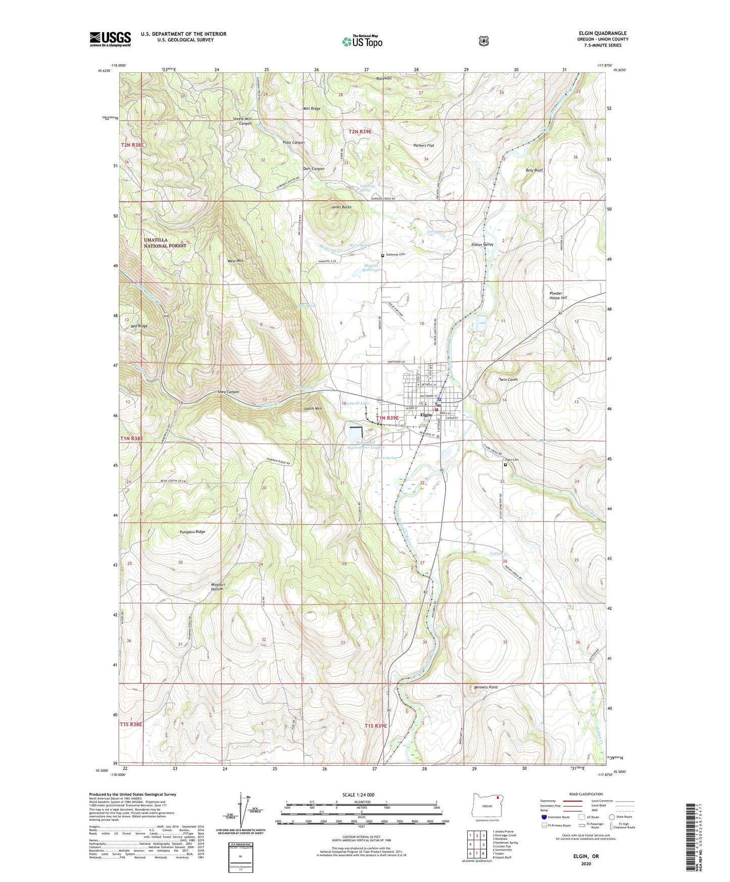
2020 topographic map quadrangle Elgin in the state of Oregon. Scale: 1:24000. Based on the newly updated USGS 7.5' US Topo map series, this map is in the following counties: Union. The map contains contour data, water features, and other items you are used to seeing on USGS maps, but also has updated roads and other features. This is the next generation of topographic maps. Printed on high-quality waterproof paper with UV fade-resistant inks.
Quads adjacent to this one:
West: Sanderson Spring
Northwest: Andies Prairie
North: Partridge Creek
Northeast: Rondowa
East: Cricket Flat
Southeast: Gasset Bluff
South: Imbler
Southwest: Summerville
Contains the following named places: Andys Rapids, Bennets Point, Big Springs, Boly Bluff, Chandler Airstrip, City of Elgin, City Pocket Park, Clark Creek, Darr Canyon, East Branch Gordon Creek, Elgin, Elgin Cemetery, Elgin City Hall, Elgin Forest Service Station, Elgin High School, Elgin Mill Wastewater Lagoon, Elgin Mill Wastewater Lagoon Dam, Elgin Municipal Court, Elgin Opera House, Elgin Outlaw Raceway, Elgin Police Department, Elgin Post Office, Elgin Public Library, Elgin Public Works Department, Elgin Rural Fire Protection District, Elgin Sewer Treatment Plant, Elgin Stampede Rodeo Grounds, Flexer Spring, Galloway Cemetery, Galloway Spring, Gordon Creek, Gulling, Hulse Airstrip, Indian Creek, Indian Creek Cemetery, Indian Valley, Indian Valley Post Office, Jones Butte, Little Phillips Creek, Martin Spring, Maxwell Lake, McCue Spring, Medicine Creek, Merritt Reservoir, Mill Ridge, Missouri Hollow, Ohm Spring, Parkers Flat, Phillips Creek, Pine Creek, Plass Canyon, Powder House Hill, Pumpkin Ridge, Rockwall, Shaw Creek, Shea Canyon, South Mountain, Steele Mill Canyon, Stella Mayfield Elementary School, Tom McDowell Park, Twin Coves, West Mountain